- South America
-
—South American.a continent in the S part of the Western Hemisphere. 271,000,000; ab. 6,900,000 sq. mi. (17,871,000 sq. km).
* * *
Continent, Western Hemisphere.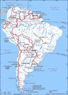 The world's fourth largest continent, it is bounded by the Caribbean Sea to the northwest, the Atlantic Ocean to the northeast, east, and southeast, and the Pacific Ocean to the west. It is separated from Antarctica by the Drake Passage and is joined to North America by the Isthmus of Panama. Area: 6,895,210 sq mi (17,858,520sq km). Pop., 2002 est.: 350,977,000. Four main ethnic groups have populated South America: Indians, who were the continent's pre-Columbian inhabitants; Spanish and Portuguese who dominated the continent from the 16th to the early 19th century; Africans imported as slaves; and the postindependence immigrants from overseas, mostly Germans and southern Europeans but also Lebanese, South Asians, and Japanese. Nine-tenths of the people are Christian, the vast majority of whom are Roman Catholic. Spanish is the official language everywhere except in Brazil (Portuguese), French Guiana (French), Guyana (English), and Suriname (Dutch); some Indian languages are spoken. South America has three major geographic regions. In the west, the Andes Mountains, which are prone to seismic activity, extend the length of the continent; Mount Aconcagua, at 22,834 ft (6,960 m), is the highest peak in the Western Hemisphere. Highlands lie in the north and east, bordered by lowland sedimentary basins that include the Amazon River, the world's largest drainage basin, and the Pampas of eastern Argentina, whose fertile soils constitute one of South America's most productive agricultural areas. Other important drainage systems include those of the Orinoco and São Francisco rivers and the Paraná–Paraguay–Río de la Plata system. Four-fifths of South America lies within the tropics, but it also has temperate, arid, and cold climatic regions. Less than one-tenth of its land is arable, producing mainly corn (maize), wheat, and rice, and about one-fourth is under permanent pasture. About half is covered by forest, mainly the enormous but steadily diminishing rainforest of the Amazon basin. Almost one-fourth of all the world's known animal species live in the continent's rainforests, plateaus, rivers, and swamps. South America has one-eighth of the world's total deposits of iron and one-fourth of its copper reserves. Exploitation of these and numerous other mineral resources are important to the economies of many regions. Commercial crops include bananas, citrus fruits, sugar, and coffee; fishing is important along the Pacific coast. Trade in illegal narcotics (mostly for export) is a major source of revenue in some countries. Most countries have free-market or mixed (state and private enterprise) economies. Income tends to be unevenly distributed between large numbers of poor people and a small number of wealthy families, with the middle classes, though growing, still a minority in most countries. Asiatic hunters and gatherers are thought to have been the first settlers, probably arriving less than 12,000 years ago. The growth of agriculture from с 2500 BC (it had begun some 6,000 years earlier) initiated a period of rapid cultural evolution whose greatest development occurred in the central Andes region and culminated with the Inca empire. European exploration began when Christopher Columbus landed in 1498; thereafter Spanish and Portuguese adventurers (see conquistadores) opened it for plunder and, later, settlement. According to terms of the Treaty of Tordesillas, Portugal received the eastern part of the continent, while Spain received the rest. The Indian peoples were decimated by this contact, and most of those who survived were reduced to a form of serfdom. The continent was free of European rule by the early 1800s except for the Guianas. Most of the countries adopted a republican form of government; however, social and economic inequalities or border disputes led to periodic revolutions in many of them, and by the early 20th century most had fallen under some form of autocratic rule. All joined the United Nations after World War II (1938–45), and all joined the Organization of American States in 1948. By the second half of the 20th century most countries had begun to integrate their economies into world markets, and by the 1990s most had embraced democratic rule.
* * *
Introductionfourth largest of the world's continents. It is the southern portion of the landmass generally referred to as the New World, the Western Hemisphere, or simply the Americas. The continent is compact and roughly triangular in shape, being broad in the north and tapering to a point—Cape Horn, Chile—in the south.South America is bounded by the Caribbean Sea to the northwest and north, the Atlantic Ocean to the northeast, east, and southeast, and the Pacific Ocean to the west. In the northwest it is joined to North America by the Isthmus of Panama, a land bridge narrowing to about 50 miles (80 kilometres) at one point. Drake Passage, south of Cape Horn, separates South America from Antarctica.Relatively few islands rim the continent, except in the south. These include the glaciated coastal archipelagoes of Argentina and Chile. The Falkland (Malvinas) Islands are east of southern Argentina. To the north, the West Indies stretch from Trinidad to Florida, but these islands usually are associated with North America. Of the remainder, most are small oceanic islands off the coasts of South America, including the Galápagos Islands, Ecuador, in the Pacific Ocean.South America has a total area of about 6,878,000 square miles (17,814,000 square kilometres), or roughly one-eighth of the land surface of the Earth. Its greatest north-south extent is about 4,700 miles, from Point Gallinas, Colom., to Cape Horn; while its greatest east-west extent is some 3,300 miles, from Cape Branco, Braz., to Point Pariñas, Peru. At 22,831 feet (6,959 metres) above sea level, Mount Aconcagua (Aconcagua, Mount), in Argentina, near the border with Chile, is not only the continent's highest point but also the highest elevation in the Western Hemisphere. The Valdés Peninsula, on the southeastern coast of Argentina, includes the lowest point, at 131 feet (40 metres) below sea level. In relation to its area, the continent's coastline—some 15,800 miles in length—is exceptionally short.The name America (Americas) is derived from that of the Italian navigator Amerigo Vespucci (Vespucci, Amerigo), one of the earliest European explorers of the New World. The term America originally was applied only to South America, but the designation soon was applied to the entire landmass. Because Mexico and Central America share an Iberian heritage with nearly all of South America, this entire region frequently is grouped under the name Latin America.South America's geologic structure consists of two dissymmetric parts. In the larger, eastern portion are found a number of stable shields forming highland regions, separated by large basins (including the vast Amazon basin). The western portion is occupied almost entirely by the Andes Mountains. The Andes—formed as the South American Plate drifted westward and forced the oceanic plate to the west under it—constitute a gigantic backbone along the entire Pacific coast of the continent. The basins east of the Andes and between the eastern highlands have been filled with large quantities of sediment washed down by the continent's great rivers and their tributaries.No other continent—except Antarctica—penetrates so far to the south. Although the northern part of South America extends north of the Equator and four-fifths of its landmass is located within the tropics, it also reaches subantarctic latitudes. Much of the high Andes lie within the tropics but include extensive zones of temperate or cold climate in the vicinity of the Equator—a circumstance that is unique. The great range in elevation produces an unrivaled diversity of climatic and ecological zones, which is probably the most prominent characteristic of South American geography.The original inhabitants of South America are believed to have descended from the same Asiatic peoples who migrated to North America from Siberia during the most recent (Wisconsin) ice age. Few of these peoples, however, survived the arrival of Europeans after 1500, most succumbing to disease or mixing with people of European and (especially in Brazil) African origin. Some parts of the continent are now industrialized, with modern cities, but the people in rural areas still follow an agricultural way of life. The wealth of mineral products and renewable resources is considerable, yet economic development in most of the continent lags behind the more industrially advanced regions of the world. Nonetheless, concern has arisen about the rapidly increasing and often destructive exploitation of these resources.Jean P. Dorst C.W. MinkelSelected World Heritage sites in South AmericaFor discussion of individual countries of the continent, see specific articles by name, e.g., Argentina, Brazil, and Venezuela. For discussion of major cities of the continent, see the articles Buenos Aires, Caracas, Lima, Rio de Janeiro, and São Paulo. For discussion of the indigenous peoples of the continent, see the articles American Peoples, Native (Native American); and pre-Columbian civilizations. Related topics are discussed in the articles arts, Native American (Native American literature); Latin America, history of; and literature, Latin American (Latin American literature). Selected World Heritage sites in South AmericaGeologic historyThe geologic history of South America can be summarized in three different developmental stages, each corresponding to a major division of geologic time. The first stage encompassed Precambrian time (3.96 billion to 570 million years ago) and was characterized by a complex series of amalgamations and dispersals of stable blocks of protocontinental crust called cratons (craton). The second stage coincides with the Paleozoic Era (570 to 245 million years ago), during which time the cratons and material accreted to them contributed to the formation first of the supercontinent Gondwana (or Gondwanaland) and then of the even larger Pangaea. The third stage, in which the present continental structure emerged, occurred in the Mesozoic and Cenozoic eras (the last 245 million years) and includes the breakup of Pangaea and Gondwana, the opening of the South Atlantic Ocean, and the generation of the Andean cordillera.The present tectonic framework of South America consists of three fundamental units: the ancient cratons, the relatively recent Andean ranges, and a number of basins. Five cratons—Amazonia, São Francisco, Luis Alves, Alto Paraguay, and Río de la Plata—represent the Precambrian core of South America, and (with the exception of the Alto Paraguay craton) these now appear as upwarped massifs arrayed from north to south in the immense eastern portion of the continent; a number of other Precambrian crustal blocks also were accreted along the margins of South America over geologic time. The lofty ranges and intermontane plateaus of the Andes rise along the entire western margin of the continent and represent the collision in the Cenozoic Era (the last 66.4 million years) of the Pacific and South American plates brought about by the opening of the South Atlantic. Finally, vast, downwarped, sediment-filled basins are found between the cratons and along the entire eastern margin of the Andes.The Precambrian (Precambrian time)Precambrian rocks constitute the oldest rocks of the continent and are preserved in the five core cratons. These rocks are represented by high- to low-grade metamorphosed assemblages along heavily deformed belts of plutonic (intrusive), metavolcanic (metamorphosed extrusive igneous rocks), and metasedimentary rocks. Rocks of Archean (Archean Eon) age (2.5 to 3.8 billion years old) are known in the Amazonia, Luis Alves, and São Francisco cratons, although precisely dated rock samples are scarce. Ages older than 3 billion years have been reported in the Imataca Complex of Venezuela and in the Xingu area of Brazil, both in the Amazonia craton. The oldest rocks found so far—with ages of some 3.4 billion years—are in the São Francisco craton in the Brazilian state of Bahia. In the other cratons (e.g., the Río de la Plata craton in Uruguay) the dating of Archean rocks has been inconclusive. Greenstone belts, which are remnants of Archean oceanic crust emplaced in the suture zones (convergent plate boundaries), contain most of South America's known large gold deposits, such as those located near Belo Horizonte, Braz. Two major cycles of crustal deformation occurred in the Precambrian, widely separated in time from each other. The first, called the Trans-Amazonian cycle, took place approximately 2.2 to 1.8 billion years ago; and the second, the Brazilian cycle, between about 900 and 570 million years ago.The Trans-Amazonian cycleTrans-Amazonian rocks can be subdivided into three distinct groups: orogenic belts, such as the Maroni-Itacaiúnas belt of the Amazonia craton or the Salvador-Juazeiro belt of the São Francisco; stable cover rocks, such as the Chapada Diamantina formation in Bahia or the Carajás and Roraima platform deposits; and large extensional dike swarms (groups of tabular intrusions of igneous rock into sedimentary strata). The orogenic belts represent old mountain chains that had been formed either along the margins of the continent as geosynclines (downwarps of the Earth's crust) and then uplifted, such as the Maroni-Itacaiúnas belt, or were the result of collisions between continental blocks, such as the Tandil belt in Buenos Aires, Arg.Such collisions are believed to have formed a supercontinent (sometimes called the first Pangaea (Pangea)) some 1.8 billion years ago. The sedimentary cover of this supercontinent (preserved on the Amazonia craton), consisting of postcollision rhyolites and clastic shelf deposits, was deep and widespread and obliterated earlier suture boundaries. Extensive stratified iron and manganese deposits are found in these sequences, such as near Carajás, Braz. Early phases of continental-plate dispersal produced extensive dike swarms of mafic rock, including a zone some 60 miles wide in west-central Uruguay where hundreds of gabbro dikes are now emplaced along a 150-mile stretch.The Brazilian cycleRocks of the Brazilian cycle today are manifested in a series of orogenic belts—developed mainly on previously deformed continental crust—that were formed during the amalgamation of the Precambrian cratons into the first supercontinent in late Proterozoic time (900 to 570 million years ago). Most of present-day South America, encompassing the platforms of Brazil, Guyana, and southern Venezuela, was accreted at this time—together with Africa—to form the western part of the huge southern supercontinent of Gondwana; Precambrian blocks that were not part of Gondwana—notably the Santa Marta Massif in Colombia, the Arequipa block in Peru, and Patagonia in Argentina—were accreted later during Paleozoic times.The Brasilides in the southern Brazilian state of Matto Grosso represent the type locality of the Brazilian orogenic cycle. There, important sequences of green schists, platform limestones, and quartzites, as well as red bed molasse formations (associated with granitoids), permit a reconstruction of the collision between the Amazonia craton's passive (i.e., without active volcanoes) margin and the Alto Paraguay craton's active margin (now partially covered by the Paraná basin). The interpreted suture zone between these two cratons corresponds to the Paraguay-Araguaia line, along which mafic and ultramafic rocks are found today.Several other Brazilian belts are known, such as the structurally complex Borborema belt and the Dom Feliciano belt in southern Brazil and Uruguay, which resulted from the collision between the Río de la Plata craton and the Kalahari craton of present-day Africa. The Dom Feliciano belt represents a complex suture zone where rocks typical of a late Proterozoic arc system were trapped between the two cratons; these rocks were then covered by plateaus of rhyolites during the Early Cambrian Period (570 to 540 million years ago). A striking coincidence exists between this suture, which is known as the Brazilian–Pan-African suture, and the inception of the future rift system that opened the Atlantic Ocean. The Pampean Sierras in Argentina are a good example of a Brazilian belt formed by accretion of an island-arc system and several small continental plates.The Paleozoic EraEarly Paleozoic eventsThe continent's early Paleozoic rocks depict the breakup of the first supercontinent, an event probably related to the separation of eastern North America from the pre-Andean basement rocks of western South America. As a result of this separation, a series of passive continental margins developed along the western side of the continent from Venezuela and Colombia to central Argentina; essentially, the Precambrian platform amalgamated during the Brazilian cycle. These rifted margins today are represented mainly by clastic rocks from the Late Cambrian and Early Ordovician periods (i.e., roughly 500 million years old) bearing numerous trilobites and graptolites, as in the Cordillera Oriental of Bolivia. The early Paleozoic rift that produced these margins also initiated the development of several large intracratonic basins within the continent (e.g., the Amazonas, Parnaíba, Paraná, and Chaco basins). Thick deposits of sedimentary rocks have since accumulated in these basins.The passive margins of the early Paleozoic were partially activated by subduction of oceanic crust (i.e., the forced descent of oceanic crust beneath the leading edge of an overriding continental plate) during Late Cambrian–Ordovician times. When the oceanic crust was totally consumed, subduction ceased and a series of small continental blocks collided against the western side of the continent. Allochthonous (transported) continental blocks thus were emplaced in the Cordillera Oriental of Ecuador, Colombia, and Venezuela at the end of the Silurian Period (about 408 million years ago). Rock ages corresponding to those of the North American Grenville orogenic belt (c. 1.3 to 1.2 billion years old), as well as affinities to North American fauna of the Devonian Period (408 to 360 million years ago), suggest that these blocks were once part of North America.Farther south, another series of blocks collided against the continent. These included the Arequipa block in southern Peru and Bolivia, the Precordillera region of west-central Argentina, and Patagonia in southern Argentina. At the same time, some minor blocks consisting of rocks exhibiting a marine affinity were accreted to the continent in the southern Patagonian archipelago of Chile.In the course of the subduction process that preceded these collisions, a series of north–south-trending belts of plutonic and volcanic rock formed offshore of the continent and parallel to the coast. Because of the later accretions of continental crust to the coastal margin, these belts were shifted more than 250 miles westward and today form prominent outcrops in northern Patagonia, the western Pampean Sierras, the Cordillera Oriental of Bolivia and northern Argentina, and the Cordillera Oriental of Colombia and Venezuela.The collision of these blocks also produced a series of peripheral foreland basins, which were the result of crustal deformation and the stacking of slices of basement rocks in the orogenic areas. Examples of basins of the early Paleozoic age are the Beni basin in Bolivia and the Alhuampa and Las Breñas basins in northern Argentina. The late Paleozoic Claromecó foreland basin in northern Patagonia is now occupied by a sedimentary accumulation more than five miles thick that was formed at the same time as the Karoo basin in southern Africa, both basins resulting from the collision of the microcontinent of Patagonia against Gondwana.The formation of Pangaea (Pangea)The Paleozoic ended with the final amalgamation of Gondwana, which together with Laurasia to the north constituted the late Paleozoic supercontinent of Pangaea. Subduction beneath the western margin of Pangaea slowly ceased. The igneous rocks formed in the volcanic arc that developed along what is now the Cordillera Central between Chile and Argentina and then along the western continental margin, are transitional in nature—i.e., the composition of the rocks changes from primarily andesitic to predominantly rhyolitic. These changes in mineral composition indicate the passage from a subduction-related compressive regime to one of extensive magmatic activity and crustal extension. Vast sheets of magma, consisting of flood basalts and of rhyolite deposits up to 2.5 miles thick, covered the west from southern Peru to the border between Argentina and Chile. Farther north this activity was partially obliterated in Cenozoic times by the uplifting of the Andes and by volcanic cover.The Mesozoic (Mesozoic Era) and Cenozoic erasEvents in the MesozoicThe mosaic of continental blocks accreted to form the Pangaea supercontinent was unstable and remained amalgamated for only a few million years. Extensive sedimentary cover indicative of arid conditions was accumulated unevenly in the late Paleozoic basins. Desertic sandstones, mudstones, and tuffs of Triassic (Triassic Period) age (245 to 208 million years ago) have preserved fossils of a rich fauna of dinosaurs and mammallike reptiles, as in the Ischigualasto basin of Argentina.A series of Middle to Late Triassic basins also developed through horizontal crustal extension during the early phases of Pangaea's dispersal. These rifted basins largely followed the previous Paleozoic sutures along the western side of the continent. Crustal extension reactivated the inner part of the supercontinent as well, with an increase in subsidence in the Parnaiba and Paraná intracratonic basins, where deposits of Triassic age have been recovered from core samples.The opening of the South Atlantic Ocean is recorded in a series of Mesozoic and Cenozoic basins that developed along the present Atlantic margin. Most of these basins have clastic red beds that date to the Late Jurassic and Early Cretaceous periods (about 163 to 97.5 million years ago). North of Porto Alegre, Braz., are found evaporite salt deposits created in marine basins with restricted circulation. Sediments formed under less restricted drift conditions began approximately 125 million years ago and are younger to the north, where they are mostly represented by clastic marine deposits. The basins of northern Brazil have carbonate deposits mixed with clastics. Deposits laid down in a restricted-circulation, anoxic (oxygen-poor) environment along the basins of Brazil and Argentina now contain abundant black shales rich in organic matter and are an important source of hydrocarbons.Open marine conditions have prevailed in the Atlantic basins since mid-Cretaceous times. The first open oceanic circulation between the South and North Atlantic oceans was established along the passive margin of South America in the Late Cretaceous Period (97.5 to 66.4 million years ago), though marine sediments had accumulated and been lithified in these basins for some time prior to that.The Andean orogenyCoincident with most of the Cenozoic Era has been the Andean orogeny, the most significant geologic event of the era. The mountain ranges, however, display some of the same features found in the previous orogenies that developed along the western continental margin, such as the classical Andean volcanic belt, the east-vergence sub-Andean thrust and fold belt, and a series of cordilleras trending parallel to the Pacific oceanic trench. These features are a response to subduction of the ocean crust that was accelerated by the opening of the South Atlantic; and this subduction overshadows all other geomorphic processes along South America's Pacific margin.The Andean orogeny has three distinct segments, each of which developed in a different geologic setting. The segments are differentiated by their relative abundances of Mesozoic-Cenozoic, metamorphic, and oceanic rocks and are divided into Northern, Central and Southern sectors.The Northern AndesNorth of the Gulf of Guayaquil in Ecuador and Colombia, a series of accreted oceanic terranes (discrete allochthonous fragments) have developed that constitute the Baudo, or Coastal, Mountains and the Cordillera Occidental. They were accreted during Cretaceous (Cretaceous Period) and early Cenozoic times. Structurally composed of oceanic volcanic arcs that were amalgamated after each collision by high-angle, west-verging thrusts, the Northern Andes are characterized by the heavily deformed metamorphic rocks and ophiolitic suites that developed during these collisional episodes. During mid-Cenozoic times, a continental magmatic arc was formed between the eastern and western cordilleras.Farther east, the Andes of Venezuela (the Caribbean Andes) resulted from the collision of the Caribbean and South American plates (plate tectonics) during Cretaceous times. This complex setting developed a series of wrench faults and related basins east of Bucaramanga (Colombia) and north of the Orinoco River delta (Venezuela). One of these basins, now occupied by Lake Maracaibo, has the largest accumulation of hydrocarbon deposits so far discovered in South America.The Central AndesThe Central Andes lie between the Gulfs of Guayaquil and Penas and thus encompass southern Ecuador, Peru, western Bolivia, and northern and central Argentina and Chile. They are characterized by their continental basement rocks and by an absence of oceanic and metamorphic rocks. The formation of the Central Andes was determined by subduction processes that occurred in the absence of major plate collisions. A period of crustal extension prevailed from the Jurassic Period (208 to 144 million years ago) to Early Cretaceous times, when important volcanic piles and plutonic rocks were emplaced. Back-arc basins developed in the sub-Andean regions, controlled by extensional faulting that occurred at about the same time the South Atlantic was opening.The middle of the Cretaceous in the Central Andes was marked by a change in tectonic activity—from crustal extension to crustal compression. This change was related to an increase in the convergence rate between South America and the adjacent oceanic plate, which initiated the formation of a series of sub-Andean foreland basins from Colombia to central Argentina. Within these basins are now concentrated most of the petroleum resources of the Andean countries.Since Cretaceous times the Central Andes have been characterized by considerable volcanism along the axis of the principal cordillera. Andesites, basalts, and rhyolites have been the major rock types to result from this activity, with some granitoids as well. Most of the gold and copper mined in Peru, Bolivia, and Chile comes from these formations.The Southern AndesThe cordilleras south of the Gulf of Penas constitute the Southern Andes. These belts are defined by a long linear batholith (large exposed mass of coarse-grained igneous rock) that now extends unbroken to Estados Island in the South Atlantic. Outcrops of Early Cretaceous mafic and ultramafic rock found south of latitude 50° S along the axis of the cordillera have been interpreted as ocean floor of a back-arc marginal basin. Metamorphic rocks of Andean age are preserved only in the Darwin Cordillera along the Fuegian Andes of Chile. The eastern sub-Andean belt is composed of a series of back-arc and foreland basins, in which sediments more than five miles thick have accumulated.Present geologic settingThe glaciations that encompass most of the Pleistocene Epoch (1,600,000 to 10,000 years ago) began in southern South America as early as the Late Miocene Epoch (i.e., about 9,000,000 years ago), when ice caps first covered the Patagonian Andes. Maximum ice expansion was reached about 1,000,000 years ago during the Early Pleistocene, when ice sheets covered the Andes from Ecuador to Tierra del Fuego. In some areas, notably Patagonia, ice extended east to the Atlantic Ocean. About 10,000 years ago the glacial ice retreated, and the present landscape of South America began to take shape. South America's contemporary geology is characterized by continued volcanic and seismic activity along the Andes and relatively aseismic conditions to the east.Victor A. RamosThe landReliefSouth America has two major mountain systems of contrasting nature. Bordering the Pacific Ocean to the west, the geologically young cordilleras of the Andes extend along the entire continent from north to south. Stretching along the continent's northern and eastern sides are the ancient Guiana and Brazilian highlands, which are much lower in elevation and slope gently to the west; farther south are the Patagonian plateaus. Lowlands—the basins of the Orinoco, Amazon, and Paraguay-Paraná rivers and the plains of the Pampas—separate the highlands from one another. Taken as a whole, the relief of the continent shows a great imbalance: the major drainage divide is far to the west along the crest of the Andes. Thus, rain that falls only 100 miles (160 kilometres) east of the Pacific may flow to the Atlantic, 2,500 miles away.The Andes MountainsThe ranges of the Andes Mountains, about 5,500 miles long and second only to the Himalayas in average elevation, constitute a formidable and continuous barrier, with many summits exceeding 20,000 feet (6,100 metres). The Venezuelan Andes—the northernmost range of the system—run parallel to the Caribbean coast west of Caracas, before turning to the southwest and entering Colombia. In Colombia the Andes—which trend generally to the north and south—form three distinct ranges: the Cordilleras Oriental, Central, and Occidental. The valley of the Magdalena River, between the Oriental and the Central ranges, and the valley of the Cauca River, between the Central and the Occidental ranges, are huge rift valleys formed by faulting rather than by erosion. An aerial view of the Andes in Colombia shows, within relatively short distances, a succession of hot lowlands interspersed with high ranges with snowcapped peaks.In Ecuador the Andes form two parallel cordilleras, one facing the Pacific and the other descending abruptly eastward toward the Amazon basin, crowned by towering peaks. Between the ranges lies a series of high basins. Three cordilleras run through Peru and are known by Peruvians as the Eastern Cordillera; the Central, or Blanca (“White”), Cordillera, named for the glaciated summit of Mount Huascarán, the country's highest peak, which rises to 22,025 feet ; and the Western, or Negra (“Black”), Cordillera, which has no snowcapped summits.South of Lima and extending through western Bolivia, the Andes branch into two distinct ranges. Between them lies the Altiplano, a vast complex of high plateaus between 12,000 and 15,000 feet in elevation and as much as 125 miles wide. The Altiplano forms a maze of depressions, hills, and vast plains without equivalent except in Tibet. Water accumulates in closed basins to form marshes and lakes, the largest of which is Lake Titicaca on the border of Peru and Bolivia. This central region of the Andes has been dissected by several rivers, all of which have cut spectacular gorges down the eastern slopes.Farther to the south—along the border between Chile and Argentina—the Andes form a single but lofty chain with many of the system's highest peaks, including Mount Aconcagua; south of Aconcagua, elevations gradually diminish. In southern Chile part of the cordillera descends beneath the sea, forming innumerable islands with steep slopes. The Andes have been deeply carved by glaciers, particularly in the south. Ice masses still occupy some 1,900 square miles (4,900 square kilometres), constituting a huge ice cap with long terminal tongues running into piedmont lakes or into the sea.The Andes are studded with numerous volcanoes (volcano) that are part of the Circum-Pacific volcanic chain, often called the Ring of Fire. Earthquakes are frequent. Almost every major city has been devastated at least once by earthquake, even along the coastal plains, where clear signs of recent vertical movement are visible.The plateausTo the north and east, the Guiana and Brazilian highlands consist of ancient crystalline rocks greatly worn through prolonged erosion. The Guiana Highlands are mostly below elevations of 1,000 feet, with small rises separated by marshy depressions. Occasional dome-shaped granitic inselbergs (inselberg) (steep-sided residual hills)—some 2,000 feet in elevation—surmount the landscape. The southern edge rises abruptly to a series of mountain chains and high tablelands (tepuis), in which the highest summit is Mount Roraima (Roraima, Mount) (9,094 feet).Covering an area of about 580,000 square miles, the Brazilian Highlands (also called the Brazilian Plateau) rise to an average elevation of about 3,000 feet and are crowned by numerous sierras (ranges). Included in this region is Bandeira Peak (9,482 feet), one of the highest points in Brazil. The São Francisco River, draining a large basin to the east, has cut deeply into the highlands. In the north the highlands slope gently to the sea, but in the east they drop abruptly, as much as 2,600 feet within a few miles. Skirting their southern edge, the Serra do Mar has summits of more than 7,000 feet in elevation. The sea has partly invaded the lower sections of the original coastal ranges and formed Guanabara Bay, which includes the harbour of Rio de Janeiro. Nearby are such steep-sided rocky peaks as Sugar Loaf (Portuguese: Pão de Açucar; 1,296 feet) and Corcovado Peak (Corcovado, Mount) (2,309 feet), which rise dramatically from the sea.In the far south, Patagonia constitutes a series of vast tablelands that rise, terracelike, from the Atlantic to the Andes and are covered with rounded pebbles and crumbling sandstones. Geologically recent volcanic eruptions have spread sheets of basaltic lava over large parts of southern Patagonia and have dotted the sedimentary plateaus with volcanic cones.The lowlandsThe Orinoco River basin is nearly coextensive with the Llanos. It lies between the Venezuelan Andes and the Guiana Highlands and is covered with alluvia brought down by the Andean torrents.The Amazonian depression, the largest river basin in the world, forms an enormous region, bounded by the Andes to the west, the Guiana Highlands to the north, and the Brazilian Highlands to the south. The ancient platform of Precambrian rock underlying the depression is covered with deep layers of alluvial sand and clay, so that it forms an immense plain of low undulations, the general eastward incline being extremely slight. The river port of Iquitos, Peru, which is about 2,500 miles from the Atlantic Ocean, is at an elevation of only 384 feet, while Manaus, Braz., far downstream in the heart of the basin, has an altitude of 144 feet.The basin of the Paraguay River, between the Bolivian Andes in the west and the Brazilian Highlands in the east, consists of a series of alluvial plains drained by a complex network of rivers interspersed with marshes. To the east, the marshes are called the Pantanal. They are only a few hundred feet above sea level. Annual flooding during the rainy season (about November through March) causes an immense swamp to form. The extensive plains west of the river, called the Gran Chaco, generally are arid.The Pampas (Pampas, the) of Argentina, covering almost 300,000 square miles, consist of a thick accumulation of loose sediments brought down from the Andes. These deposits, 1,000 feet deep at Buenos Aires and even deeper in other places, have completely buried the ancient features of the land. The landscape seems perfectly level, although it actually rises imperceptibly toward the west—from near sea level at Buenos Aires to 2,320 feet at Mendoza. Some ranges, such as Córdoba and San Luis, are conspicuous features on the otherwise flat plains.DrainageDrainage is notably affected by the physical dissymmetry of the continent. The major basins lie east of the Andes, and the main rivers flow to the Atlantic Ocean. The four largest drainage systems—the Amazon, Río de la Plata (Paraguay, Paraná, and Uruguay rivers), Orinoco, and São Francisco—cover nearly three-fourths of the continent.By far the largest system is formed by the Amazon River, which stretches some 4,000 miles across equatorial South America. The volume of water it carries surpasses that of all other rivers, constituting one-fifth of the total flowing fresh water of the world. About 6,350,000 cubic feet (179,800 cubic metres) of water per second is emptied into the Atlantic by the Amazon, which is more than 10 times the outflow of the Mississippi River. The Amazon drains some 2,722,000 square miles—about two-fifths of South America—and has more than 1,000 tributaries, several of which are more than 1,000 miles long. Rising in the central Peruvian Andes, it is named the Marañón (Marañón River) in its upper course; after being joined by several rivers—including the Ucayali (Ucayali River), from which the Amazon's length traditionally is measured—it escapes from the Andes through narrow canyons (pongos). If measured from the Marañón-Ucayali confluence, the Amazon is second in length only to the Nile. However, more recent measurements have claimed that the Amazon's source is farther into the Andes, suggesting that the Amazon is the world's longest river. Near Manaus, it is joined by the Negro River, which drains much of northern Brazil. The Amazon, then at full strength, winds through the low plains to pass between the Guiana Highlands and Brazilian Highlands before emptying into the Atlantic.The second most important drainage system, estimated to cover at least 1,600,000 square miles, is formed by the Paraguay, Paraná, and Uruguay rivers. These empty into the Río de la Plata (Plata, Río de la), which actually is an estuary and not a river. About 2,800,000 cubic feet of water per second discharge from the common mouth of these rivers, an outflow second only to that of the Amazon. The Paraguay River, with a length of 1,584 miles, rises in the Bolivian hills and empties into the Paraná River. The Paraguay is a river of the plains, flowing across a wide stretch of marshes (the Pantanal) in its middle course; its lower course, however, is drier. The Paraná has a total length of 3,032 miles; its upper course (generally called the Alto Paraná) flows mainly across the eastern high plateaus before its confluence with the Paraguay, after which the river flows through a broad floodplain before emptying into the Río de la Plata. The Uruguay River, at 990 miles, is the shortest of the three; it flows east of the Paraná before discharging into the Paraná delta near Buenos Aires.The Orinoco River basin is the third largest drainage system, covering about 366,000 square miles. With a length of some 1,700 miles, the river first flows west and then north, plunging down a series of steep slopes. It then flows northeast and east along the edge of the Llanos, a flat plain that stretches westward to the Andes. Near the ocean, the Orinoco divides into a series of distributaries to form its delta. A unique feature of the upper Orinoco River is Casiquiare River, which allows water to flow from the Orinoco to the Amazon system, as well as in the reverse direction during high tide in the Amazon.The basin of the São Francisco River, encompassing some 244,000 square miles, is South America's fourth largest drainage system. The river, which flows entirely within Brazil, has a total length of 1,811 miles. It rises in the state of Minas Gerais and flows northward for 1,000 miles before curving eastward to the Atlantic. The São Francisco has been an important artery of communication since colonial times and is the location of several large hydroelectric projects; many irrigated fields are found around the São Francisco reservoir.The remainder of the continent's Atlantic-flowing rivers are of much less importance. Among the largest are the Magdalena in Colombia (navigable in its lower section) and the Essequibo, Maroni, and Oyapock in the Guianas.Drainage to the Pacific is different because of the close proximity of the Andes to the Pacific coast and the scarcity of rainfall from southern Ecuador to central Chile. Consequently, the rivers are short, and few carry any large quantity of water. The major rivers are the Guayas (Guayas River) in Ecuador, on which the port of Guayaquil is located, and the Santa in Peru. Some torrents have had great importance since early times, when good water management facilitated the development of ancient civilizations. In central Chile the valleys of the Aconcagua, Maule, and Bío-Bío rivers have remained fertile agricultural regions.Most of South America's important lakes are confined to the Andes or their foothills. Because of the chain's complex topography, water has accumulated in closed basins to form natural reservoirs. Among permanent Andean lakes, the largest is Lake Titicaca (Titicaca, Lake), which lies at an elevation of 12,500 feet between Peru and Bolivia. The lake is 120 miles long and up to 50 miles wide, although it was much more extensive in the past. Lake Junín in central Peru; Lake Sarococha, also in Peru, between Puno and Arequipa; and Lake Poopó in Bolivia also rank among the larger Andean lakes. They exhibit uniform physical conditions throughout the year, in terms of temperature and percentage of dissolved gases. In addition, they remain ice-free up to an elevation of 16,000 feet, and, as a result, the climate of their shores is temperate.Piedmont lakes are found in Patagonia where, in the wake of melting glaciers, lakes formed downslope in natural basins. Among these are Lakes Buenos Aires, Argentino, and Nahuel Huapí. Their eastern parts, which stretch to the end of the Argentine plateau, generally have gently sloping banks bordered by low mountains, while their western parts form a series of narrow, fjordlike arms that lie between steep slopes. Bodies of water such as Lake Maracaibo in Venezuela and Dos Patos Lagoon in southern Brazil, both located on coasts, formed when longshore drifts sealed the exits to the sea.Marshes and swampsVast marshes are found in poorly drained depressions in many parts of the continent. One of the widest marshy areas is the Pantanal, in the middle course of the Paraguay River; it is subject to flooding in December, reaching its highest watermark in June, when it becomes an immense swamp. Swamps of another type occur in the rain forests, mostly in the Amazon basin and in northwestern Colombia. In some places the ground is inundated throughout the year, whereas in other areas swampy conditions occur only at the time of the annual flood, as is the case with the annually flooded plains known as várzeas. Finally, wide, marshy areas border the mouths of the Orinoco and Amazon rivers, and mangrove swamps of various types are found along the lower river valleys and coasts from southern Ecuador northward, less continuously along the Caribbean coast, and south along the Atlantic coast to southeastern Brazil.SoilsMore than 20 distinct soil regions can be found on the South American continent as a result of its geologic history, topography, climate, and vegetation. Three major groupings correspond to the continent's three primary land regions—the lowlands, the highlands, and the Andes.Low natural fertility is a conspicuous feature of soils in the humid tropic regions of South America. About half of the continent's soils consist either of unconsolidated and nutrient-poor sediments (e.g., kaolins [china clays] and quartz sands) deposited in river basins, latosols (laterite) (red soils leached of silica and containing residual concentrations of iron and aluminum sesquioxides), red-yellow podzols (Podzol) (acidic soils with a bleached upper horizon, or layer, that are low in lime), and regosols (Regosol) (azonal soils consisting mainly of imperfectly consolidated material and having a complex morphology). About one-fifth of the continent is covered by arid soils of various types in which agriculture is risky without irrigation. Other regions, representing about 10 percent of the total area, are poorly drained, the soils being either gleys (clayey soils in which the substrate is bluish gray, generally sticky, and often structureless because of excessive moisture), groundwater laterites, grumosols (soils with a high content of expanding clays), or planosols (Planosol) (a type of soil found in humid climates in which soluble salts and minerals are leached out of the upper layers and are cemented or compacted at a lower level). In the Andes, slopes are often steep, and lithosols (shallow soils consisting of imperfectly weathered rock fragments) abound, accounting for another 10 percent of the continent's surface. In the inter-Andean valleys and on some of the foothills, nevertheless, eutrophic soils (deposited by lakes, and containing much nutrient matter, but often shallow and subject to seasonal oxygen deficiency) can be found.Fertile soils, therefore, extend over only about 10 percent of the surface of South America. The most important of these are brunizems (deep, dark-coloured prairie soils, developed from wind-deposited loess), chestnut soils, and ferruginous tropical soils. On the low coastal ranges, in the foothills of the western Andes, and on the nearby plains and terraces of Colombia and Ecuador, the soils consist mainly of red-yellow latosols, podzols, and alluvial soils. Soils in southern Brazil and Uruguay consist of brunizems, reddish prairie soils, and planosols. The Argentine Pampas, the largest fertile area on the continent, is uniformly covered with the so-called pampean loess, which is calcareous, rich in minerals, and mixed with volcanic sediment. Less rich soils are found in the uplands of northeastern and central Brazil, consisting mainly of sandy regosols in the north and red latosols in the south.The agricultural development of South America closely reflects the distribution of soils according to their fertility. It is mostly confined to the eastern mid-latitude plains, in which is concentrated the production of cereal grains and cattle grazing; to the subtropical and temperate parts of the Andes, from Colombia to Chile, where grazing takes place and a variety of crops are cultivated; and to eastern and southeastern Brazil, where coffee, cacao, soybeans, and sugarcane are grown, while the interior plateaus are devoted to cattle grazing.Soil erosion has ravaged a large part of the continent. According to some estimates, in several countries half or more of the presently arable land has been severely damaged or ruined by poor land management. In the Andes, land that once produced high yields of wheat is now abandoned. Mountain forests are still cleared for cattle grazing and cultivation, which greatly accelerates erosion and ruins the soil of the region for years thereafter. Soil damage has been less severe in areas of relatively flat terrain. Campaigns for soil conservation or restoration have been implemented in most countries.South America extends over a wide latitudinal range, thus encompassing a great variety of climates. South America's broadest extent is in the equatorial zone, so that tropical conditions prevail over more than half of the continent. Elevation, particularly in the Andes, is another important climatic control.Factors influencing climateThree principal factors control the features of South America's climate. The first and most important of these are the subtropical high-pressure air masses over the South Atlantic and South Pacific and their seasonal shifts in position, which determine both large-scale patterns of wind circulation and the location of the rain-bearing intertropical convergence zone (ITCZ). The second is the presence of cold ocean currents along the continent's western side, which affect both air temperatures and precipitation along the Pacific coast; on the Atlantic coast, warm currents are predominant. Finally, the orographic barrier of the Andes produces a vast rain shadow over much of the southern tier of the continent.The South Atlantic and South Pacific high-pressure cells take the form of great semipermanent anticyclones (anticyclone) (centres of high atmospheric pressure around which winds circulate), the positions and mean intensities of which change with the seasonal north-south migration of the Sun. The eastern part of the South Pacific anticyclone influences the climate of most of South America's west coast, causing stable, subsiding air conditions that yield minimal precipitation. The cold Peru (Peru Current) (Humboldt) Current, flowing northward along the coast from southern Chile to the Equator, cools and further stabilizes the Pacific air that drifts over the continent. One of the world's driest regions, the Atacama Desert along the northern coast of Chile, results from these conditions. The east coast (north of Patagonia), by contrast, receives greater amounts of precipitation from the winds emanating from the South Atlantic, and the humidifying action of the warm air currents forms a belt of low pressure.The ITCZ (intertropical convergence zone) is responsible for the seasonal character of precipitation in South America's extensive tropical wet-dry climatic zone. The trade winds of both hemispheres converge between the subtropical anticyclones of the Northern and Southern hemispheres in this low-pressure region. A migrating zone of unstable atmospheric conditions results, bringing periods of prolonged, abundant precipitation. The ITCZ follows the annual migration of the Sun and reaches its most northerly position during the Southern Hemisphere's winter, which is the driest period for most of tropical South America.The southern tier of the continent is unaffected by the ITCZ and falls instead under the influence of cold fronts and the mid-latitude westerlies, which are particularly strong in the Southern Hemisphere because of the large extent of ocean area there and the unimpeded air flow this allows. As the westerlies rise over the Andes, most of their moisture is released in orographic precipitation, while on the lee side a typical rain shadow develops over the vast desert and semidesert region of Patagonia.Vertical climatic zones are particularly well-defined in the Andes, ranging from humid to warm (tierra caliente) at the base or foothills; temperate and semi-humid (tierra templada) at mid-level; cool and dry (tierra fría) in the highlands; and cold to freezing (tierra helada) in the glacial summit areas.Climatic regionsSouth America can be divided into four major climatic regions—tropical, temperate, arid, and cold—their parameters determined by the elements described above.Tropical climatesAmong the tropical climates, the tropical rainy, or rain forest (tropical rainforest), type occurs on the Pacific coast of Colombia, in the Amazon basin, on the coast of the Guianas, and on part of the coast of Brazil. The average daily temperature is about 86° F (30° C), with monthly and annual variations of less than about 5° F (3° C). Heavy rainfall, well-distributed throughout the year, averages about 98 inches (2,500 millimetres) annually in Belém (Brazil), about 108 inches in Iquitos (Peru), and 71 inches in Manaus (Brazil). The Chocó region of Colombia—one of the wettest areas in the world—receives in excess of 400 inches, and it rains more than 300 days per year. In the Amazon region, rains do not fall evenly over the basin. The southern part receives most of its rainfall during the Southern Hemisphere summer (October to April), while the northern part has its rainy season during the Northern Hemisphere summer (May to September). The “dry” season is neither lengthy nor noticeable; humidity is always high.The second type of tropical climate—the tropical wet-dry, or savanna (grassy parkland), type—is characterized by high temperatures (all monthly means above 64° F, or 18° C) but receives less precipitation and experiences a prolonged dry season. This type of climate is found on the fringes of the tropical-rainy belt, in the Orinoco basin, on the Brazilian Highlands, and in part of western Ecuador. Temperatures are still high and annual variations small, but daily temperature extremes are greater, typically ranging from a low of 65° F (18° C) to a high of 95° F (35° C).Temperate climatesThe temperate climates have a greater range of temperatures than the tropical climates and may include extreme climatic variations. These climates, characterized by lower winter temperatures, are south of the Tropic of Capricorn (in Paraguay, parts of Bolivia, Brazil, Argentina, and Chile) and in the mid-level elevations of the Andes. On the Atlantic side, temperatures in the warmest month average 77° F (25° C), but cold-month averages vary from 63° F (17° C) in the north (Asunción, Paraguay) to 50° F (10° C) in Buenos Aires, Arg. Rainfall exceeds 1.5 inches each month in the east but decreases to the west. In central Chile, between latitudes 32° and 38° S, the climatic features are similar to those of the Mediterranean, with mild winters and winter rains; summers, however, are cooler (69° F, or 21° C, in Santiago, Chile, in January—9° F, or 5° C, cooler than in Mediterranean locations). In southern Chile, winter temperatures are lower but not as low as the latitudes would indicate. The southern islands and channels have a relatively uniform cool climate throughout the year, and winters are much less severe than in Labrador, for example, which is at a comparable latitude and maritime location in the Northern Hemisphere. The presence of glaciers is the result of snowy winters and cool, cloudy summers during which ice does not completely melt. Rainfall is abundant (102 inches in Valdivia, Chile, and probably twice this figure on the western slopes of the mountains), and the southernmost west coast is one of the wettest regions in South America. A short distance inland, however, after passing into the lee of the Andes, rainfall decreases considerably (20 inches at Ushuaia, Arg.). Thus, in Patagonia an unusual situation exists in which these variations in rainfall result in significant differences in climate from west to east than from north to south.Arid climatesWarm and cold deserts and certain coastal and interior regions are classified as arid climates. Patagonia and northwestern Argentina constitute the largest of the interior arid regions. Rainfall is low, only about four inches in San Juan in the north and about seven inches farther south in Neuquén. The annual range in average monthly temperatures in Patagonia—the greatest in South America—is more than 36° F (20° C), the result of warm summers and cold winters. The Atacama Desert, a narrow strip along the Pacific coast between latitudes 5° and 31° S, is a coastal desert. The cold seas associated with the Peru Current and the proximity of the high Andes produce an inversion of normal atmospheric temperatures, as air in contact with the water cools more rapidly than the upper strata of air. The result is a nearly continuous layer of stratus clouds about 1,200 feet thick, lying at altitudes varying between about 1,000 and 3,000 feet, that prevents air near the ground from being warmed. Temperatures, consequently, are relatively low: Lima has an average annual temperature of 64° F (18° C), ranging from about 72° F (22° C) in February to about 59° F (15° C) in August. The coast of Peru thus is the cloudiest—and one of the driest—deserts in the world, with no sunshine for at least six months of the year. It almost never rains, except under abnormal circumstances, but condensation of fog (called garúa by the Peruvians) provides a limited amount of moisture. A warm coastal desert extends from northeastern Colombia to Venezuela, covering a zone where rainfall is scarce and droughts are prolonged.Finally, the belt that forms in northeastern Brazil, between the Parnaíba and São Francisco rivers, is classified as an interior warm arid zone. The interior highlands act as a wedge separating the sea winds from the northeast and those from the southeast, which carry their moisture beyond the region. Average annual rainfall is less than four inches, and the dry season may last as long as seven months. The worst feature of the area's climate is the irregularity of the rainfall, as a result of which severe droughts plague the region.Cold climatesAreas where average annual temperatures are less than 50° F (10° C) are characterized as cold climates. These occur in the southernmost parts of Argentina and Chile and in the high Andes above about 11,500 feet. Mean temperatures are relatively low throughout the year, but daily variations are wide. There is a marked difference in humidity between the northern and southern parts of the upper Andean zone. In Colombia and Ecuador the climate at such altitudes is cool and damp. Temperatures, always low, may on the average vary daily from 54° F (12° C) during the daytime to 28° F (-2° C) at night. Rainfall generally is high and well distributed throughout much of the year, although most of the Ecuadorian Andes have a dry period from June to August. Clouds and mist are dense in much of the region, and sunlight penetrates only for short periods. From central Peru to Bolivia and Chile, temperatures are still lower. Near Lake Titicaca, the average annual temperature is only about 34° to 36° F (1° to 2° C); November is the warmest month, with an average temperature of 41° F (5° C), while the coldest month, July, has an average of 28° F (-2° C). Daily variations are considerable; typically, a daytime maximum of 68° F (20° C) may drop to a nocturnal minimum of 5° F (-15° C). Annual rainfall varies from 24 to 56 inches but is concentrated during the southern summer. The dry season is long and is characteristically accompanied by drought. Winds are continuous and often violent, aggravating the coldness and the dryness of the climate, which produces a harsh environment. As in any mountainous region, climate varies largely according to local conditions.Jean P. Dorst C.W. MinkelPlant lifeSouth America possesses a distinctive plant life. The biotic region is called the Neotropics (Neotropical region), and its faunal realm the Neogaean. This region extends southward from the Tropic of Cancer and includes Central and South America—even the temperate southern portion. There are some similarities between South America's vegetation and that of other continents, as a result of past geologic developments. The pattern of distribution within the continent is complex because of the variety of climatic and ecological zones. The northern tropical regions are the richest in diversity, while the southern regions and the western Andean highlands are much impoverished, despite some differentiation.GrasslandsGrasslands are abundant in the South American lowlands. They can be classified as tropical, as with savannas, or subtropical, as with the Argentine Pampas.Savannas (savanna)Tropical savannas are found mostly in the Llanos of Venezuela and northeastern Colombia. These vast plains are covered with grasses and sedges, but tree clusters (mainly palms) also grow, especially along streams.The flat or softly rolling plains called Pampas, which constitute the greater part of eastern Argentina, are covered with grasses. It is believed that the Pampas were originally covered with trees but that the trees were removed by humans. Others think that the plains were always covered with grassy vegetation, citing the existence of the ombu, a scrubby treelike plant that is part of the grass family, as an example. Exotic pines, eucalypti, oaks, and poplars constitute introduced trees. To the south the Pampas merge with the Patagonian steppe, where tussock grasses are mixed with scattered low bushes and spiny plants.Vegetation zonesThe proportion of endemic plants in South America is very high, even at the family level. Among angiosperms (plants having seeds enclosed in an ovary) no fewer than 25 families and 3,500 genera are endemic to the tropical and temperate zones. Others are related to African plants or belong to southern plant groups also distributed in southern Africa and in Australasia. Vegetation is by no means uniform throughout the continent; its distribution is determined by climatic, geographic, soil, and sometimes anthropic (human-related) differences.Tropical and subtropical rain forests (tropical rainforest)Rain forest covers the largest part of the Amazon (Amazon Rainforest) region, most of the Guianas, southern and eastern Venezuela, the Atlantic slopes of the Brazilian Highlands, and the Pacific coast of Colombia and northern Ecuador. The Amazon region is the largest and probably the oldest forest area in the world; it also ascends the slopes of the Andes until it merges with subtropical and temperate regions. On its southern border it mixes with the woodlands of the Brazilian state of Mato Grosso, with galleries of trees extending along the rivers. Consisting of enormous trees, some exceeding a height of 300 feet, the rain forest is composed of an almost incredible number of species growing side by side in the greatest profusion and arranged in different strata. There are about 2,500 species of Amazonian trees. In the region of Manaus, Braz., for example, 1,652 plants belonging to 107 species in 37 different families were found on about 1,900 square feet.The forests of the swamps (swamp) (igapós), where the ground is inundated or very marshy throughout the year, cover the lowlands. Characteristic trees are, among others, jacareúbas (Calophyllum brasiliense), which is a tall tree with hard reddish brown wood used for heavy construction, araparis (Macrolobium acaciaefolium), abiuranas (Lucuma species), piranheiras (Piranhea trifoliata), and louros-do-igapo (Nectandra amazonum). Undergrowth is dense.In the annually flooded plains known as várzeas, trees are higher and quite diversified; they include oeiranas (Alchornea castaneifolia), a euphorbia (i.e., characterized by a milky juice), and the trumpet tree (Cecropia peltata), a rapid-growing tree of the mulberry family with a light wood. Palms and hevea (wild rubber plants) grow in these forests. The forests of the nonswampy areas are rich in hardwoods, of which acapu (a tree with dark brown wood), pau-amarelo (Euxylophora paraensis), pau-santo (Zollernia paraensis), massaranduba (a Brazilian tree with light reddish brown wood), jarana (a tree with hard, heavy, durable wood), and matamata (a tree with hard, heavy, durable wood, used for pilings) are the best known. Hevea and the Brazil nut tree (Bertholletia excelsa) are characteristic of these forests where spiny palms cover the ground.Epiphytes (nonparasitic plants that grow on other plants, deriving moisture and nutrients from rain and air) are numerous, mostly Bromeliaceae (a family having spiny leaves), orchids, and ferns. Lianas abound, particularly in drier forests.Tropical deciduous forests (monsoon forest)These forests, dominated by trees of moderate height, notably of leguminous species, are found widely throughout northern South America, where the climate is characterized by a prolonged dry season, notably in Venezuela, Colombia, and the Brazilian Highlands.CaatingaCaatinga (white forest) refers to the generally stunted, somewhat sparse, and often thorny vegetation of the dry interior of northeastern Brazil. Trees, leafless for long periods and able to resist drought, also are characteristic, particularly in the basin of the São Francisco River. Dominant species are leguminous trees, particularly catingueiras (Caesalpinia), juremas (Mimosa), and joazeiros (Zizyphus joaseiro), members of the Euphorbiaceae (spurge) family, and Bombacaceae (a family of tropical trees with palmate leaves and large, dry or fleshy fruit). Undergrowth consists of thickets, bromeliads (plants with basal, often spiny leaves), and innumerable cacti, among which is the xiquexique (Cereus gounellei), the complicated intertwinings of which cover the soil. Where more water is available, caatinga species may grow 30 feet high and form impenetrable thickets.South Brazilian forestsThese parklike forests, sometimes very dense but interspersed with savanna, occupy vast expanses from the border of the Amazonian rain forest to the marshes of the upper Paraguay River. The typical landscape is a grassland strewn with smaller trees. In effect, it includes a mosaic of associations, from hygrophilous (living or growing in moist places) to xerophilous (adapted to dry conditions) forests and even desert.Notable is the araucaria, or Paraná pine (Araucaria angustifolia), forest region, between the Paraná River and the Atlantic Ocean, stretching from Curitiba, Braz., to northern Argentina. Araucarias (which are not true pines) dominate a dense forest of numerous species including hardwoods, yellowwood (Podocarpus), and the South American holly (Ilex paraguariensis), from which the beverage maté is made.Xerophytic associationsThickets of small trees and shrubs, often thorny, among which species of Prosopis, Acacia, and Mimosa predominate, cover regions that alternate between dry and relatively wet seasons; these regions particularly include coastal Venezuela, northeastern Colombia, southwestern Ecuador, and northern Peru.In Peru this association borders the coastal desert, which extends from northern Peru to northern Chile, with a width of 50 to 100 miles. Only a few shrubs and some terrestrial (as distinct from epiphytic) bromeliads grow in this area, which becomes greener only in the Andean foothills, where cacti and other xerophytic plants are found, and along the valleys of rivers flowing down from the Andes. In some areas of Peru, winter mists bring humidity, which causes a specialized type of vegetation, lomas (a mix of grasses and other herbaceous species), to grow for a short period of time.Subantarctic rain forestsTemperate rain forests—similar to those found in British Columbia and in the northwestern United States—grow in southern Chile at low and moderate altitudes, thanks to abundant rainfall. The most typical trees belong to the genus Nothofagus (beech trees found in the cooler parts of the Southern Hemisphere), the northern species of which are evergreen and the southern species deciduous. Various conifers, notably the alerce and araucarias, mingle with the leafy trees. A dense undergrowth of shrubs, lianas, bamboos, ferns, mosses, and epiphytes grow in the northern districts but disappear toward latitude 49° S. In southern Chilean Patagonia, forests consist of twisted, creeping trees merging into a kind of heath.Mountain vegetationIn the high Andes, a temperate zone extends from the upper limit of the subtropical rain forest (about 6,000 feet) up to the lower limit of the Andean meadows,at an altitude of about 11,000 feet in Ecuador and Peru. This zone is very humid on the Amazonian side because of rising air, where both the epiphytes and the undergrowth are dense, creating a cloud forest.The upper zones have a peculiar vegetation that touches the snow line. In the wet northern Andes in Colombia and Ecuador, Alpine meadows called páramo consist of grasses and other herbaceous plants, often with bright flowers; these are surmounted by taller plants, especially the showy frailejones (Espeletia), which grow 15 to 20 feet high and are crowned by large bouquets of long hairy leaves.In the south, páramo vegetation merges with that of the high plateaus, notably the tola, a tough wind-resistant shrub, in the Altiplano of southeastern Peru and western Bolivia. Typical vegetation consists of rough grasses, between which grow a variety of herbaceous, cushion, and rosette plants, shrubs, and cacti. Vegetation extends to the limit of permanent snow but becomes scarce at higher elevations, where soil is often barren.Human influences on vegetationHuman activity has transformed the original vegetation cover to a large extent throughout South America, particularly in forested areas. The forests of eastern Brazil were ravaged in the process of clearing the ground for crops, especially sugarcane. The araucaria forests in the southern states of Brazil have been rapidly vanishing, as they have been exploited for timber. The slopes of the Andes are so severely deforested (deforestation) that it is not apparent that they once were covered with trees. In the Amazon region, hundreds of square miles of tropical rain forest are cut annually, and the forest no longer is the enormous inviolate mass it once was. In Patagonia the practice of burning to convert remaining patches of forest into pasture steadily increases. Animal herders have severely damaged grasslands through overgrazing, from the Venezuelan Llanos through the high Andes, to Tierra del Fuego. The destruction of habitats continues to accelerate throughout the continent, despite the growing concern of those favouring conservation.Animal lifeSouth American animal life is particularly rich and well diversified as a result of the wide range of habitats. Moreover, because of its isolation from the rest of the world during the Tertiary Period (about 65.5 to 2.6 million years ago), the South American landmass is characterized by considerable biological originality. Many animals belong to exclusive groups, and even at the family level the percentage of endemic forms is high. Speciation has reached a higher degree in South America than in other parts of the world. Nonetheless, there are some similarities between South America's fauna and that of other continents as a result of past geologic developments. Ancient groups of animals including mollusks, chilopods, some fishes, reptiles, and amphibians show affinities with the animal life of Africa, Australia, and New Zealand. More recent species, mostly vertebrates, migrated from North America. Animals such as armadillos, anteaters, porcupines, and opossums migrated in both directions.Principal faunal typesFish and bird lifeFreshwater fishes are numerous, with about 2,700 species, though they derive from only a few ancestral groups. Amazonian fishes may approach 1,500 species in number. Among the dominant groups are characins (800 species), which include the flesh-eating piranha; gymnotids, South American cyprinoid fishes that include the electric eel; catfishes; cyprinodonts, a large family of small scaly-headed soft-finned fishes; and cichlids, a family consisting chiefly of fishes that somewhat resemble sunfish.Birds (bird) are represented by 89 families and some 3,000 species—a much higher figure than in Africa or Asia, which justifies the application of the name bird continent to South America. Twenty-five families are endemic to the Neotropical region. Unique birds include rheas (large, tall, flightless birds that resemble ostriches), curassows (large arboreal birds distantly related to the domestic fowl), hoatzins (a brownish crested bird, having claws on the digits of the wing when young), oilbirds, motmots (bright-coloured birds related to kingfishers), jacamars (small, bright-coloured birds), toucans, manakins, and cotingas (related to manakins), and many passerine (perching) birds. Hummingbirds have evolved to fill a variety of habitat niches, with more than 120 species in Ecuador alone. Parrots, pigeons, cuckoos, tyrants (a kind of flycatcher), woodhewers, and orioles are among the dominant groups. Remarkably, the proportion of nonpasserine to passerine birds is greater in South America than in any other part of the world. Several species of penguins are native to southern South America, the coastal regions of Peru and Chile, and the Galapagos Islands.MammalsThe range of mammals includes those that existed on the continent before its complete isolation, such as marsupials (pouched animals) and sloths, those that migrated to the continent, and those that migrated to and from South America. Smaller mammals such as monkeys and rodents were among the first to migrate to South America. Later, tapirs, deer, bears, rabbits, and many others arrived, as did the camel family, which gave rise to vicuñas, guanacos, alpacas, and llamas some 6,000 years ago.Amphibians and reptilesAmphibians are well represented by caecilians (small wormlike, burrowing amphibians), salamanders, toads, and a number of varieties of frogs, including clawed frogs, the most aquatic of all. The tree frogs, arboreal amphibians, are particularly abundant through the Amazon basin and are very different from their African and Asian counterparts, although the frog faunas of Australia and South America often are strikingly alike. Reptiles include a great variety of turtles and tortoises, crocodiles, caimans (endemic crocodilians), geckos, many iguanas, teiids (a family of mostly tropical American lizards), Amphisbaena (a genus of harmless, limbless lizards), and many snakes, including boas, anacondas, colubrids (a very large family of nonvenomous snakes), coral snakes, and vipers.ArthropodsMost South American insects, spiders, crabs, centipedes, and millipedes are found nowhere else in the world. Thousands of species, especially insects of the tropical rain forest, have yet to be classified. South America has the richest array of butterflies of any continent, including the spectacularly coloured members of the Morphidae subfamily; the social insects—termites, ants, wasps, and bees—also are well represented. Many of the best-known arthropods (e.g., mosquitoes, sand flies, and kissing bugs) are responsible for the transmission of human diseases such as dengue and malaria.Ecological communitiesAnimal communities are distributed according to the pattern of vegetation zones, and several well-defined groups can be distinguished. They include regions as diverse as the Amazonian forests and the high Andes.The Amazonian and Guianan forestsThe most diverse community is found in the Amazonian and Guianan forests, where the abundance of water and trees makes life easy. Rivers are the realm of large numbers of invertebrates and fishes, such as pacu (Metynnis), a big brownish flat fish, the meat of which is highly valued; coumarou (Curimato), which is a toothless vegetarian fish resembling the marine mullet; electric eel (Electrophorus electricus); pirarucu (Arapaima gigas), which can attain a length of 15 feet and a weight of 200 pounds; and piranha, having teeth so sharp that they can cut through flesh like a razor; as well as a wealth of small fishes, many of which are vividly coloured. The manatees (a chiefly tropical, aquatic, herbivorous animal with a broad tail) and the inia, a primitive dolphin, frequent the larger rivers of the region. The Amazon river turtle (Podocnemis expansa) persists despite intense exploitation. Crocodiles and caimans (called jacares in Brazil) inhabit the main waterways.Amazonian forests constitute an environment to which most animals responded by becoming arboreal. Tree frogs can move across the surface of the leaves thanks to adhesive pads on their feet; lizards have very elongated fingers; monkeys, sarigues (a close relative of the opossum), and kinkajous (a nocturnal, carnivorous mammal) have prehensile tails. Birds are numerous and, because of the enormous amount and variety of available foods, well diversified. Antbirds, tyrants, cotingas, tangaras (brilliantly coloured birds related to the finches), hummingbirds, toucans, woodpeckers, barbets (loud-voiced tropical birds closely related to honey guides), parrots, and tinamous (quail-like terrestrial birds) are the dominant groups. Many of them never leave the forest canopy, where they display their brilliant colours, which contrast with the more modest plumage of those birds that live in the undergrowth. Mammals are represented by a number of terrestrial or half-aquatic species, such as very small deer; some large rodents (including the agouti, paca, and capybara); tapirs; and carnivores (including the jaguar). Primates range from pygmy marmosets to larger durukulis (small, round-headed, stocky-bodied, bushy-tailed monkeys), woolly monkeys, spider monkeys, and howler monkeys. Bats also are numerous, including species that feed on fruit and others that eat fish. Sloths feed on the leaves of certain trees, among whose branches they remain much of their lives. The predators are represented by carnivorous mammals, a series of snakes—including anacondas and boas—and large raptors (birds of prey), such as the harpy eagle (Harpia harpyja), the most powerful bird of prey to be found in the world. Insects, including a great variety of butterflies and ants, are innumerable.East-central plateaus and lowlandsThe Brazilian Highlands have an impoverished animal life, from which species that are strictly adapted to the dense forest are excluded. The plains of Uruguay and the Gran Chaco have a varied animal life that includes some particular species, such as the maned wolf. The marshes are inhabited by a wealth of waterfowl, as well as by a species of lungfish (Lepidosiren paradoxa) that is related to its African and Australian counterparts.The Argentinian PampasThe Pampas (Pampas, the) of Argentina are inhabited by a limited number of indigenous animals. Among the birds are rheas and a series of smaller birds, including the popular ovenbird (Furnarius rufus), the name of which comes from its globe-shaped nest made of mud. Endemic mammals include the mara (Dolichotis patagona), a long-legged, long-eared rodent; the plains viscacha (Lagostomus), a burrowing rodent related to the chinchilla; the guanaco (Lama guanacoe), a South American mammal related to the camel but resembling a deer; and Pampas deer (Blastoceros campestris). The restricted number of the larger herbivorous mammals is quite remarkable and illustrates the scarcity of recent mammalian types in the Neotropical region.The southern Chilean forestsThe forests of southern Chile are inhabited by a specialized animal life, with a high percentage of endemic species. Parakeets and hummingbirds are found as far south as Tierra del Fuego. A marsupial, the rincolesta of Chiloé (Rhyncholestes raphanurus), is one of the most primitive mammals still in existence.The high Andes (Andes Mountains)The high Andes have an impoverished animal life. Species there have had to adapt to the harsh and cold environment, scanty vegetation, and low oxygen pressure. The great number of lakes in the region has attracted many aquatic birds, including flamingos, which nest up to elevations of 16,000 feet in northern Chile, and amphibians such as the giant toads of Lake Titicaca, which spend their entire life in water. Mammals are represented by the guanaco and vicuña (both wild ruminants related to the domesticated llama), deer, and numerous rodents, including viscachas, chinchillas, and guinea pigs. Predatory species include foxes, pumas, the spectacled bear (the only bear species in South America), and many birds of prey, notable among which is the condor, the giant of living birds, with a wingspan of more than 10 feet.The arid west coastThe limited variety of animals that inhabit the arid coast of Peru and northern Chile is especially striking when compared with the richness of offshore marine life. The cold upwelling water of the Peru Current, rich in salts, are swarming with life, from plankton to fishes, including the Peruvian anchovy (Engraulis ringens); these small forms of life provide food for higher levels of the marine community, represented, for example, by sea lions and birds, many of which are endemic to the area. Birdlife includes a penguin, many species of gulls and terns, shearwaters, petrels, cormorants, pelicans, and boobies (a kind of gannet). Three kinds of these birds—the guanay (or Peruvian cormorant; Phalacrocorax bougainvillii), the variegated booby (Sula variegata), and the brown pelican (Pelecanus occidentalis)—nest by the millions on small islands off the coast, where their droppings accumulate to form guano, a highly prized fertilizer.Human influences on wildlifeOverhunting and habitat destruction have seriously depleted populations of wild animals in much of South America. Almost all wild species are less abundant than they were before the mid-20th century, and some are threatened with extinction. Laws designed to protect wildlife frequently are not observed. In addition, many rural people, especially in tropical-forest areas, still depend on game as a source of food; and the sale of live animals for pets or laboratory use has further depleted stocks. Populations of animals not considered economically valuable have been reduced as their forest habitats have been removed.Nature reserves, established to protect animals in their habitat, are now found in most South American countries. Argentina pioneered wildlife protection on the continent by creating Nahuel Huapí National Park. At Iguaçu (Iguazú) Falls—located on the Iguaçu River on the border between Brazil and Argentina, just before the confluence of the Iguaçu and Paraná rivers—two national parks, one in each country, protect wildlife and the surrounding rain forest. Manu National Park in southeastern Peru protects one of the richest collections of plant and animal life in the Amazon basin, including more than 1,000 species of birds. Venezuela's effort to protect habitats led to the establishment (1962) of Canaima National Park in the Guiana Highlands, which with an area of nearly 11,600 square miles is the largest park on the continent. Overall, South America has about 58,000 square miles of parks, but the inviolability of many of these sanctuaries against the pressures of economic development has not been clearly established in all countries.The people (South America)Ethnic origins and migrationsFour main components have contributed to the present-day population of South America—American Indians (Amerindians), who were the pre-Columbian inhabitants; Iberians (Spanish and Portuguese who conquered and dominated the continent until the beginning of the 19th century); Africans, imported as slaves by the colonizers; and, finally, postindependence immigrants from overseas, mostly Italy and Germany but also Lebanon, South Asia, and Japan.Before the beginning of the epoch of European exploration and conquest in the early 16th century, South America was almost completely occupied by diverse peoples. Nearly all of these cultural groups practiced agriculture, and most exhibited an extraordinary understanding of their physical environment that had been developed over thousands of years. Although areas such as deserts, mountain peaks, and tropical rain forests appeared to be uninhabited, most of these places were occupied at least occasionally. The societies with the greatest complexity of social organization and densest population tended to be located along the Pacific coast, in the adjacent Andes, and along the major rivers of the Amazon basin. Less complex societies were located away from the rivers and mountains, and nomadic hunting tribes were sparse in the Pampas, Patagonia, and southern Chile.Agriculture-based village culture and social organization came first to the tropical lowlands of the Amazon basin and valleys of coastal Ecuador and Colombia (c. 3000 BC). This culture included religious temple-mound complexes, fine ceramics (based partly on earlier technology for making fire-engraved containers out of bottle gourds), and farming such crops as cassava (manioc) and corn (maize) on periodically flooded plains and levees. These areas eventually became organized into complex chiefdoms containing dense populations, supported in some cases by raised fields—broad planting surfaces separated by ditches that enhanced the fertility of the soil while limiting the possibility of fungal diseases and waterlogging.The practice of agriculture spread to the desert coast of Peru and Chile and then into the higher elevations of the Andes, and new farming technologies appeared. In coastal areas, elaborate irrigation (irrigation and drainage) networks supported ceremonial centres and (later) true cities such as Chan Chan (near present-day Trujillo on the northern coast of Peru), the capital of the Chimú state. Coastal Peruvian and Ecuadorian cultures (such as Moche and Nazca) produced superb ceramic art and finely woven textiles. In coastal Chile the Mapuche (Araucanian) culture effectively occupied its region through farming and hunting.In the highlands, fertile soils of volcanic ash were cultivated with the digging stick and a type of foot plow called the chaquitaclla. Highland soils also were improved by constructing long earthen irrigation canals or (in the Central Andes) some of the world's most elaborate and beautiful stone-walled terracing. In most parts of the Andes, areas of high population density were organized into chiefdoms—such as the Chibcha of Colombia and the mound (tola) builders of Ecuador—led by powerful, paramount lords. Early cities and empires first developed around Huari (Wari) in south-central Peru and Tiwanaku (Tiahuanaco) in western Bolivia, but the last and best-known empire was that of the Inca (Inka). Called Tawantinsuyu, the Inca state expanded from its homeland in the Cuzco Valley of south-central Peru north to what is now southern Colombia and south to the Maule River in central Chile (the northern limit of the Mapuche culture). The Inca easily conquered the desert coastal cultures by threatening their water supplies but never succeeded with the chiefdoms of the Amazon basin and of coastal Ecuador. Thus, when Inca expansion was halted by the Spanish in the 1530s, the empire was long but narrow, confined to the Andes and the Pacific coast. This empire did not include other advanced agricultural cultures of the continent, because those cultures migrated to Colombia, Venezuela, east into the Amazon basin, and south into the Mapuche area.Certain areas of South America—notably in the more remote parts of the interior, away from the main rivers—were occupied by simpler village cultures based on shifting (shifting agriculture) cultivation, an agricultural practice still used in many of these areas. Nomadic hunter tribes were located in areas of present-day Uruguay and Argentina and in the extreme south (Tierra del Fuego and Cape Horn). Although these cultures appeared to be simple in organization and technology, they were well adapted to hunting wild animals (e.g., the guanaco), fishing, and gathering edible plants and shellfish in a harsh environment.The number of Indians at the time of the conquest is uncertain: estimates vary from 8 to 100 million for North, South, and Central America combined (for the Inca, from 3 to 32 million). More recent estimates that put South America's preconquest population at about 20 million seem more realistic.Equally controversial is the origin of South America's Indians. Most anthropologists believe that they are descended from people who migrated to North America from Asia between about 60,000 and 20,000 years ago, having crossed the Bering Strait separating northeastern Asia and northwestern North America. It is not known when humans first arrived in South America, although it is fairly certain that people were present in Chile by 11,000 BC.IberiansUntil the end of the era of Iberian domination, only the Spanish and Portuguese were admitted to their South American colonies. The rigid exclusion of all other foreigners had but few exceptions, though a small number of non-Iberian Europeans settled as a result of illegal or tolerated immigration. Most of the Spaniards came from Castile and the southern regions. Little is known about the principal regions from which the Portuguese came. It is estimated that the total number of licencias (authorizations to emigrate) granted by Spain was about 150,000 for the entire colonial period, which lasted from the 16th to the 19th century; it is possible that the number of illegal immigrants also approached this number. Of these, no more than two-fifths of the emigrants went to South America. Up to one million Portuguese may have migrated to Brazil, drawn primarily by a gold rush in Minas Gerais in the 18th century.Africans (Africa)A few African servants accompanying the early Spanish or Portuguese explorers were the first slaves to enter the continent. Larger-scale importation of slaves from Africa developed after the slave trade was established early in the 16th century, though reliable quantitative information is lacking. Estimates of the number of Africans brought to South America are four million for Brazil and three million for all of Spanish America, of which most went to areas of present-day Venezuela, Colombia, coastal Ecuador and Peru, and northwestern Argentina; a number also went to the large Spanish colonial cities as urban servants. In addition, many Africans were brought to the British and Dutch Guianas (present-day Guyana and Suriname, respectively). African slaves were considered to be more resistant than American Indians to tropical diseases, especially in plantation areas. Most of the slaves imported into South America came from Portuguese or Spanish trading posts along the west coast of Africa, including areas near present-day Angola. The slave trade ceased in the early 19th century as most of the new republics banned slavery.Postindependence overseas immigrantsMost of the South American countries gained independence in the early 19th century, thus bringing an end to the legal exclusion of foreigners. Mass immigration to the continent, however, did not begin until after 1850, acquiring momentum in the last three decades of the century and continuing until 1930, when it decreased abruptly. Some 11 to 12 million people arrived in South America; the great majority of these went to Argentina (more than half) and Brazil (more than one-third). Although many later left, the demographic and sociocultural impact of this influx was tremendous in Argentina, Uruguay, and (to a lesser extent) in southern Brazil. Immigration to other countries was numerically insignificant (although socioculturally meaningful), except in Uruguay, where because the preexisting population was not numerous, the proportion of foreign-born was high—about one-fifth in 1908 and even higher in the 19th century. In Argentina the proportion of foreign-born reached nearly one-third of the total population and stayed at that level for many years. In both cases the contribution of post-independence immigration was proportionally much higher than in the United States at the peak of mass immigration.The great majority of the immigrants were Europeans—Italians (forming nearly half of the immigrants in Argentina, one-third of those in Brazil, and probably the majority of immigrants in Uruguay), the Spaniards (one-third in Argentina), and the Portuguese (nearly one-third in Brazil). Other small but socially relevant immigrant streams arrived from central and eastern Europe. This source of immigration became more important in the 20th century and especially during the 1930s and '40s, when it included more middle-class and educated people, among whom were many Jews and other refugees. After World War II another smaller wave of immigration arrived from Europe (principally from Italy and Spain), directed mostly to Venezuela and Argentina.Other immigrant groups arrived from East and South Asia and from the Middle East. Chinese labourers came in the 19th century to help build South American railways and established Chinese districts in such cities as Lima. Labourers from South Asia were brought by the British to Guyana, and similar migrants came to Suriname, supplemented by workers from the East Indies (Indonesia). Lebanese migrated to South America from the Ottoman Empire prior to World War I; known locally (and incorrectly) as “Turks” (turcos), these Lebanese became important in commerce and even politics in such cities as Guayaquil, Ecuador. Since World War II, Koreans have migrated to Argentina (under a negotiated treaty) and under less formal conditions to countries as diverse as Paraguay and Ecuador, where they often have become involved in commerce and industry. The largest Asian group by far, however, has been the Japanese. Before World War II large numbers of Japanese settled in Brazil, Bolivia, Peru, and Argentina. People of Japanese ancestry now are found primarily in the Brazilian states of São Paulo, Santa Catarina, and Rio Grande do Sul, as well as in Argentina and Peru; collectively they constitute the largest concentration of ethnic Japanese residing outside of Japan.Population and ecological distributionThe present populationThe present population of South America is the result of four centuries of mixture among these four components—American Indians, Iberians, Africans, and more recent overseas immigrants—and their descendants. The mixing process began when the first Iberians reached South America. The previous traditions and basic values and attitudes of the Iberians—coupled with other characteristics of their conquest and colonization—facilitated intermixing not only with the Indians but in general among all the various ethnic groups, although the intensity, extent, and frequency of this mixing varied both among different groups and at different times.Legal marriage between Iberians and Indians was tolerated, often permitted, and even, in some special circumstances, promoted. It was possible—and in certain epochs easy—to recognize mestizo (generally, mixed European and Indian) children, though frequently a mestizo was considered automatically illegitimate. Social custom did not permit intermarriage between Europeans and Africans and between Africans and Indians and their offspring, though it failed to prevent generalized ethnic mixing. This prolonged process created a great variety of physical types, resulting in the emergence of a complex terminology to describe them.The more specific designations are mestizo (called caboclo in Brazil), mulatto (mixed European and African ancestry), zambo (African and Indian ancestry), and cholo (mestizo and Indian ancestry). During the postindependence period of European immigration, other national groups contributed to diverse ethnic mixtures. As a result, the ethnic compositions of Argentina and Uruguay were completely modified.Culture areasMany South Americans resist recognizing ancestry as being socially significant, especially as language, religion, and other cultural aspects tend to cross ethnic lines. In practice, however, an individual's ethnic background can be a factor in determining social status, educational attainment, and economic opportunities. Ethnic distinctions tend to be geographic in nature and can be divided into three broad types of regions based on a predominant ethnic element in what otherwise are mixed populations, with those three elements being people of predominantly American Indian, African, and European descent. These regions have been defined to a large extent since the end of the colonial period. The people within them, however, are not of uniform ancestry but rather are clustered into different cultural groups. Moreover, ethnicity in South America is often self-determined.American Indian heritage regionsIncluded in this designation are the Amazon and Orinoco basins, Paraguay, northern and central Chile, and the highlands of Venezuela, Colombia, Ecuador, Peru, and Bolivia. These were the areas of pre-Columbian chiefdoms and states at the time of the Spanish conquest. It was possible to grasp the social and economic organization of the Spanish empire on the relatively advanced institutions of these cultures; at the same time, Indian labour could be easily exploited. The original Indian population suffered from what has been regarded as a demographic disaster—during the first century of Spanish domination, the Indian population declined up to 95 percent in some areas—but a substantial number of Indians survived, and mixing between Indians and Europeans often was intense. Indian populations in the highlands began to recover during the 18th century. The European component of the population was confined to towns and cities in colonial times, followed by more recent migrations to areas of the Amazon basin during the rubber boom of the early 20th century. African populations were limited to plantation zones in warmer mountain valleys and along the coast. In Chile a pronounced shift toward identification with European culture took place, even though the population had a substantial proportion of Indian ancestry.African heritage regionsThis category includes the coastal areas of the Guianas, Venezuela, Colombia, Ecuador, and Peru; most of eastern Brazil; and northwestern Argentina. Most of these areas are not considered “black” today but rather are identified in regional terms. Thus, coastal Ecuadorians in general are called montuvios, coastal Peruvians criollos, and northwestern Argentines criollos or gauchos. Many Colombians of African descent who were designated as mulattos in colonial censuses were called mestizos in later censuses. Changes in African cultural identity were facilitated by the rapid adoption of the Christian religion and European languages in slave populations.European heritage regionsMost of the people included in this grouping live in a belt extending from southern Chile through Patagonia and the Pampas to southern and southeastern Brazil. Part of this area was inhabited by hunter-gatherers at the time of the Spanish conquest, and these peoples strongly resisted European domination until they were decimated by modern warfare in the 19th century. The Brazilian area was populated by Indians who had been displaced westward by slave raids during colonial times. People of European and Japanese ancestry were drawn into these regions in the 19th and 20th centuries by the possibility of developing forms of commercial agriculture—especially wheat and dairy farms and cattle and sheep ranches—similar to those in their homelands.Linguistic (South American Indian languages) patternsThe linguistic diversity and multiplicity of South America probably is unmatched anywhere else in the world. Thousands of languages and dialects have been cataloged, including all those that have developed since the European conquest. Classification systems vary a great deal—from more than 100 “linguistic families” and many unrelated languages at one extreme to extremely simplified schemes at the other. There also is considerable disagreement on the composition of these “stocks” and how many languages should be classified. Most are now extinct, either because the peoples who spoke them have disappeared or because of acculturation into a European language or, in some instances, into another indigenous tongue.The survival of Indian languages in the Indian-American areas has depended on a variety of factors. Colonial authorities helped spread Quechuan languages (those spoken by the Inca) because they were convenient for missionary activities and for government, and these languages often displaced local indigenous languages. Elsewhere, local languages gave way to new languages such as the língua-geral of Brazil (combining Tupí-Guaraní and Portuguese). In many cases populations became bilingual, with an Indian language spoken at home and Spanish used for public transactions; examples include the Spanish-Guaraní speakers of Paraguay and the Quechuan-Spanish speakers throughout the Andes.The largest surviving indigenous language groups are Quechuan, Aymaran, Tupí-Guaraní, and Mapuche. Quechuan languages are in use primarily in the Andean highlands (southern Colombia to Bolivia) but also in large areas of the Amazon basin and in northwestern Argentina. Quechuan, collectively the third largest language group in South America after Spanish and Portuguese, is not spoken by all Andean highlanders but is limited to certain sharply defined geographic domains. Aymaran languages are spoken in northwestern Bolivia, southeastern Peru, and small areas of northwestern Argentina and northern Chile. Most people in Paraguay speak Spanish and a dialect of Tupí-Guaraní (Tupí-Guaraní languages) and consider themselves to be mestizo Paraguayans rather than Indians. Mapuche speakers, who constitute the largest Indian population in Chile, are restricted to the south-central part of the country, with smaller groups found in Argentina, especially in Neuquén province.A great many other Indian languages also are spoken by members of numerous smaller groups, many of which are extremely localized and some of which are on the verge of extinction. These groups are found primarily on the periphery of lowland regions, in areas once isolated from slave trading and the rubber trade. Relatively few lowland groups are located in Brazil, the rest being found in the Hispanic countries. Among the larger groups of the Amazon basin (excluding Quechua speakers) are the Chiquitanos of eastern Bolivia, the Arawaks (Campa, Machiguenga, etc.) and Shipobo of east-central Peru, the Cocama-Cocamilla of northeastern Peru, the Jívaroans along the Ecuador-Peru border, the Tikuna of the Brazil-Colombia-Peru border region, the Yanomamo of the Venezuela-Brazil border region, and the Makushí along the Brazil-Guyana border. Groups south of the Amazon basin include the Guaraní of southeastern Bolivia and northwestern Argentina and the Toba of northern Argentina. North of the Amazon basin are the Arawaks of Guyana, the Goajiro and Sinu (Cenú) of northern Colombia, and the Emberá along the Colombia-Panama border. The Quillacingas of Colombia occupy lands just to the north of the Quechua domain.Religious patternsSouth American Indians traditionally practiced shamanism, a belief system in which chosen individuals use alternative medicine and natural elements to cure illness and to avert harm. Indigenous cultures also practiced rites of passage and seasonal rites, animal (and human) sacrifice, and ceremonial drinking. The Inca built temples, maintained a priesthood and a class called Chosen Women who were dedicated to the service of the gods, and performed pilgrimages.The Iberian invaders considered most Indian practices to be superstition rather than heresy, and over time they were able to convert the indigenous population to at least a formal observance of Roman Catholicism. Perhaps 85 percent of the South American population now professes Catholicism. In Brazil, tens of millions of people combine Catholicism with African elements in such religions as Macumba and Candomblé. Newer movements such as liberation theology have enhanced the popularity of Catholicism in many communities. Protestantism has been long present in the Guianas, and it became more widespread in the late 20th century, especially in Chile, southern and southeastern Brazil, and among the Aymara of Bolivia and Quechua speakers of central Ecuador. The largest Jewish communities are in the cities of Buenos Aires, São Paulo, and Rio de Janeiro.Sociological changesAll or most legal discrimination against the Indians and other ethnic sectors of the population was nominally abolished either at the time when the individual countries became independent or during the 19th century. The real conditions of the Indians (and to a certain extent of the Africans after the abolition of slavery in Brazil in 1888), however, remained the same or became worse, since, on one hand, liberal legislation tended to eliminate all communal property and the legal existence of the Indian communities, while, on the other, various forms of exploitation continued unchanged. These de facto conditions also were reinforced by the 19th-century racist pseudoscientific doctrines of white supremacy.In the late 20th century and early 21st century, however, a partial change in intellectual attitudes and political conditions has resulted in initiatives toward improving the conditions of these groups. In Brazil, for example, institutions such as the Protective Service for the Indians (Serviço de Proteção do Indio) and the National Indian Foundation (Fundação Nacional do Indio) were established, although such organizations often have become agents for the relocation and control of Indian groups rather than for their interests and survival. Christian missionaries sometimes have acted as representatives of Indian rights. Indians of the Andean highlands have benefited from land reforms (land reform) enacted since 1950 in Bolivia, Peru, and Ecuador, although these reforms often have defined rural peoples as “peasants” rather than as Indians. Such groups as the Aguaruna and the Shipibo in eastern Peru have been able to take advantage of programs by which some Indians actually have become the landlords of mestizos. National parks and protected areas have been established for such peoples as the Yanomamo of Brazil and Venezuela and the Huaorani of Ecuador.Large-scale Indian-rights movements have appeared in the highlands, which have attempted to link different Quechua-speaking groups into broader unions in order to obtain land and political recognition; often these movements have claimed that Indian groups constitute nations in their own right. Lowland Indians also have organized—as in the Kayapó of Brazil and the Shuar of Ecuador—and larger, pan-Indian movements have emerged that have striven to unite disparate groups at the national and international level. Coupled with the rise of these movements has been a growing interest in Indian languages, technology, music, and medicine and an effort to use indigenous knowledge to provide appropriate economic development and help conserve the South American landscape.Gino Germani Gregory W. KnappDemographic patternsThe continent's demographics reflect an unusual settlement history: South America is a “hollow continent,” with most of the population concentrated around its margins. The highest population densities are found in the old Indian core areas of the Andes, the former slave areas of northeastern Brazil, and the areas of European immigration in southern Brazil, Uruguay, and Argentina. The interior is relatively empty because of the decline in Indian populations, poor communications with coastal areas, and the absence of economic opportunities capable of attracting large numbers of immigrants. Another characteristic of South American demography is a high rate of population growth in tropical regions coupled with moderate growth in the temperate southern cone. The high tropical growth rates, however, have begun to diminish.Both South American demography and history can be explained through the changing patterns of birth and death rates and immigration caused by the Iberian conquest and by subsequent economic development. After the conquest, diseases such as smallpox, measles, malaria, and yellow fever decimated Indian populations, leading to a long-term pattern of high death rates and declining or stagnant populations, even where fertility was high. Beginning in the area of European migration and extending throughout the continent after World War II, innovations in public health, such as safe drinking water and vaccines, have resulted in a dramatic drop in death rates everywhere except remote rural areas and urban slums.The demographic transition and fertilityThe resultant population explosion has been caused by a traditionally high fertility rate and a modern low mortality rate. The situation can be thought of as the second of three stages. The first stage, which characterized most of South America during the 18th and 19th centuries, involved a rough population balance maintained by high death and birth rates. The second, transitional, phase has consisted of a population explosion brought about by declining mortality and continued high fertility. The third is a modern stage where low fertility and low mortality bring population stability.Fertility rates are a result of many factors, including the availability and cultural acceptability of birth-control measures. In general, economic factors increasingly have come to dominate in decisions regarding family size, including the benefits of young children to families and the costs of rearing children to adulthood. Children traditionally have had considerable value in helping families in their farming or urban-craft livelihoods and in providing security for the elderly. The costs of maintaining children in such circumstances were low, and women had few opportunities outside the household to compete with child-raising.Changes in fertility in South America have occurred with the expansion of mandatory education, which simultaneously has raised the cost of rearing children, reduced their benefits to families, and provided young women with the education needed to seek employment. A decline in birth rates occurred in the early 2000s because of improved access to birth control. Birth rates declined first in the prosperous areas of the southern cone, but all regions have experienced the effects of growing educational and employment opportunities for young women in an increasingly urbanized environment.Effects of rapid population increaseRapid population expansion has had important demographic and social effects. Two examples are especially illuminating.At the peak of population growth during the second stage, the proportion of children tends to be high, while in the third stage it is low. In South America the proportion of the population under 15 years is still relatively high. As a consequence, the group of people in their productive (working) years is greatly reduced. This high ratio creates a heavier burden for the working group, while the economy is not able to raise the productivity level needed to compensate for it.Another crucial consequence is the so-called urban (urbanization) explosion. Argentina and Uruguay have become two of the most urbanized countries in the world, but their urban growth has been the result of large-scale foreign immigration. The dramatic increase in urban concentration began approximately in the 1930s. In all of Latin America, the proportion of urban centres with more than 10,000 inhabitants increased from one-fourth in 1950 to about three-fourths in 40 years.South America now is one of the most urbanized regions in the world, following the industrially advanced areas. Although the rate of growth in larger cities has decreased since 1950, the urban population has continued to be concentrated in the larger districts: a large proportion of the urban, and in some cases of the total, population lives in a single urban centre. This situation prevails in Uruguay, Argentina, Chile, Paraguay, and Peru.Much of the growth of South America's largest cities has come about from natural increase. Migration has remained important, however, because of unfavourable conditions in the countryside. Land ownership often has been concentrated in a few hands, while “urban bias” in national policy has been reflected in price controls for or subsidized imports of foodstuffs, concentration of health, recreational, and educational facilities, and the expansion of government bureaucracies in large cities. Attempts to reverse urban bias have met with strong political opposition. There also have been pressures from rural guerrilla movements, especially in Peru, which has caused an especially rapid migration to Lima.The unequal distribution of population in South America—the “hollow continent” phenomenon—is likely to continue and even become more pronounced. Although certain frontier areas, such as Rondônia state in Brazil and the coca-growing regions of the Andes, have attracted substantial in-migration, these flows have been far less than the out-migrations to towns and cities in already densely populated areas. Development of the interior increasingly has relied on labour-saving technology, resulting in little incentive for migration. As the largest cities face overcrowding and increased crime rates, a likely solution will be the urbanization of surrounding rural centres.Gregory W. KnappThe economyAs a group, the economies of South American countries have changed profoundly since the 1970s. This has come as a result both of external conditions beyond the control of these nations and of internal policy decisions made to produce change. At the most fundamental level, these countries mainly are exporters of relatively low-value primary products and semiprocessed materials and importers of higher-value manufactured goods. Great efforts have been made across the continent to expand the manufacturing sectors and to reduce dependency on imports.From the 1930s until the late 1980s, the majority of South American countries pursued economic development strategies based on a system of import substitution. National governments used such measures as tariff and price policies to boost domestic industries and protect them from external competition. They also created joint ventures with private capital and established state-owned enterprises, especially in the heavy industries, utilities, and transportation. They provided high subsidies for social programs in areas such as education and public housing. Furthermore, national spending on armaments and “defense” soared during periods of military rule.South American countries borrowed from foreign private banks and international lending institutions, such as the World Bank and the Inter-American Development Bank, to fund existing programs while also trying to expand their economic productivity through investments in areas such as transportation, energy generation, industrialization, and agricultural modernization. However, many countries lived well beyond their means through the wholesale borrowing of funds at high interest rates on the world market. Consequently, they were forced to borrow more and more money just to service the interest payments that accumulated annually on their outstanding debt, thus creating the so-called “debt crisis.”With the debt crisis, insolvency befell many South American countries. After decades of substantial progress in its economic development, the region as a whole regressed significantly in the 1980s. Between 1980 and 1990, gross domestic product (GDP) per capita measured in constant dollars declined for every South American country except Brazil, Colombia, and Chile. For a part of this same period, inflation rates skyrocketed in many countries, exceeding 3,000 percent per year in some instances. Currency devaluation, austerity programs, and governmental disinvestment were the most commonly used remedies to check these problems.The severity of their problems and lender demands prompted most South American countries to initiate fundamental restructurings of their economies. These reorganizations were made in accord with neoliberal, or “free-market (capitalism),” economic theory, which came to dominate the region's economic planning and growth strategies in the 1990s. Emphasis was placed on stimulating economic growth through selling state-owned enterprises to private investors and eliminating or severely curtailing support for social programs. These actions were meant to increase productivity, reduce governmental expenditures, and diversify economic activities. Regional economic integration also had taken on importance in order to broaden markets. These changes had the greatest impact on those lowest on the socioeconomic ladder. At the turn of the 21st century, the economies of many South American countries started to improve, and some of those countries were able to start paying off their debts. Notably, Ecuador adopted the U.S. dollar as its currency in 2001, provoking protests from indigenous communities and the working poor; however, this conversion, as well as a rise in oil prices, helped stabilize the Ecuadorean economy the same year. Argentina, the victim of an economic crisis in 2001 when it defaulted on its foreign debt, had begun a recovery by 2003. Increasing economic independence sparked a trend of nationalization along with the election of left-leaning leaders in Venezuela, Brazil, Chile, Argentina, Ecuador, and Bolivia.Ed.Ernst C. GriffinResourcesMineral resourcesSouth America is relatively rich in mineral resources. However, they are highly localized: few countries have a good balance of fuels and raw materials within their boundaries, and two countries, Uruguay and Paraguay, are nearly devoid of mineral wealth. Nevertheless, South American economies have traditionally relied on a foundation of mining, fishing and forestry, agriculture, and non-exportable manufactures.Mineral fuelsLarge quantities of oil (petroleum) and natural gas are found in several areas within South America. The greatest quantities are located in the sedimentary layers surrounding Venezuela's Lake Maracaibo (Maracaibo, Lake) and the adjacent Caribbean coastal margin. Venezuela also has major deposits of oil and natural gas in the area surrounding El Tigre. The country is one of the world's largest oil producers and exporters. The Venezuelan government's seizure of operational control of foreign-owned private oil operations in 2007 had important implications for the region. That same year, the natural gas reserves and oil industry of Bolivia (centred in the eastern lowlands around Santa Cruz) were nationalized. Since 1972, Ecuador has also been a major oil exporter, exploiting fields in the Amazonian region east of the Andes. Oil fields were brought into production in the early 1970s in the Peruvian portion of the Amazon basin west of Iquitos. Argentina and Chile share significant deposits bordering the Strait of Magellan in Patagonia and Tierra del Fuego. Additionally, Argentina has traditional oil-producing regions around the Patagonian city of Comodoro Rivadavia. Brazil has limited offshore oil and gas reserves. Colombia has long been self-sufficient in oil and gas production, with primary areas in the central Magdalena River valley and the Putumayo area adjacent to its border with Ecuador.South America is poor in coal. Colombia exports coal from La Guajira Peninsula and the lower Magdalena River basin south of Barranquilla, and Argentina has limited quantities of good-quality coal at El Turbio in the extreme south. Brazil produces relatively small quantities of coal in its southern states, while areas in northwestern Venezuela and south of Concepción in Chile also have coal mines that once supplied fuel for steamships.South America contains about one-fifth of the world's iron ore reserves. The most important beds are located in Brazil and Venezuela, supplying domestic iron and steel industries as well as significant exports. The great majority of the continent's reserves are in the Brazilian states of Minas Gerais, Pará, and Mato Grosso do Sul, where lodes of magnetite and hematite ores contain up to 50 to 65 percent iron content. In Venezuela, sites like Mount Bolívar and El Pao in the Sierra de Imataca at the base of the Guiana Highlands have reserves of ore containing a high percentage of iron. High-quality beds of this type are also found at Mutún, Bol., and in the central part of the Chilean Andes. Oolitic iron ore (i.e., ores consisting of small round grains cemented together) is found at Sierra Grande in Argentina and Paz del Río in the Cordillera Oriental of Colombia. In addition, important iron ore deposits are located at Marcona, Peru, and along a narrow belt from Taltal to Ovalle in northern Chile. Lateritic deposits of ferrous hydroxides are widespread, mainly in Colombia, Brazil, and Argentina.Among ferroalloys, manganese occurs in sedimentary forms in the Brazilian states of Amapá and Minas Gerais, as well as in highland Bolivia. It is also found in much lesser quantities in Argentina, Chile, Ecuador, and Uruguay. South America is generally deficient in nickel, chromite (chromium ore), and cobalt, although small quantities of all these minerals are found along with other industrial trace minerals in the central Andes of Peru, in several areas of eastern Brazil, and in the central and northern Argentine Andes. Chile has the second largest reserves of molybdenum in the Americas, trailing the United States.Nonferrous base metalsNonferrous metals are abundant in South America. The continent's copper reserves represent more than one-quarter of the world's known reserves, nearly all of which are found in Chile and Peru. In Chile the Chuquicamata deposits of the northern Atacama Desert contain the largest amounts of copper known in the world and have ores containing 2.5 percent copper. The El Teniente mine in the Andes southeast of Santiago also has important copper reserves. Peru's most important deposits are found in the country's central Andean ranges near Yauricocha, Morococha, Casapalca, Cerro de Pasco, and Huarón, as well as in the south, where the Toquepala mine opened in 1960. Copper also is found in Argentina and highland Bolivia and at Caraíba in the Brazilian state of Bahia.Bolivia ranks among the world's four or five largest tin producers. Sedimentary deposits and veins of tin occur in the country's eastern Andes in a narrow belt extending roughly from Oruro to Potosí. Significant tin deposits also occur in Brazil's western Amazon basin near the Madeira River. lead and zinc are dispersed among many countries but are found in greatest abundance in the central Andes of Peru; in the state of Minas Gerais, Brazil; in highland Bolivia; and in the northern Argentine Andes. bauxite is extracted in Guyana and Suriname; there are also major production centres near Ciudad Guayana in Venezuela and in several places in the eastern Amazon basin of Brazil. Small quantities of mercury occur in the central Andes of Chile and near Huancavelica in Peru. Antimony is found in Bolivia and in lesser quantities in central Peru.Precious metals and gemstonesDespite the fact that South America was Europe's treasure trove for gold and silver (silver processing) from the 1530s through the late 1700s, in the early 21st century the region contributes only a small percentage to the world's production of these precious metals. Brazil is South America's leading gold producer, with deposits in the Amazon basin accounting for much of the output. Traditional mining centres in Minas Gerais, Goiás, and Mato Grosso have diminished in importance. Placer deposits in Colombia's Atrato River basin are significant sources of gold, and the metal is still produced also in Venezuela and in classical gold-mining centres in the central Andes of Peru, in the Andes of Chile, and in the Carajás area in Brazil. Peru has historically been one of the world's main silver exporters, primarily from mines extending from Cerro de Pasco to Huancayo in the Andes, but production has decreased since the early 1970s. Ecuadorean silver is located primarily in the Andes, while Colombia, Argentina, and Bolivia also exploit this metal in their highland areas. Platinum is found in the Cordillera Occidental of Colombia as well as in smaller quantities in association with the copper-mining activities of central Peru.Many regions of South America, mainly in Brazil, are famous for their gems (gemstone). The ancient bedrocks of the Brazilian Highlands, especially in the states of Minas Gerais and Goiás, are rich in precious and semiprecious stones, including diamonds (diamond). However, Brazil contributes only a small percentage to world diamond production.Other precious or semiprecious stones abound in the same region, notably topazes, tourmalines, beryls, aquamarines, chrysoberyls, garnets, opals, and sapphires, as well as quartz of sufficiently high grade for use in the electronics industry. Colombia is famous for its emeralds (emerald), found primarily in the Muzo mines of the Cordillera Oriental.Various elements used in industry, such as beryllium, niobium (columbium), tantalum, thorium, lithium, rare-earth metals, and mica, are extracted in South America. Brazil, from the Northeast through Minas Gerais, and Argentina's Sierra de Córdoba are important sources for these minerals.Nonmetallic depositsSouth America has few significant reserves of phosphates or potash, the primary bases for many fertilizers. The Atacama Desert of northern Chile has large deposits of nitrates (nitrate and iodate minerals), which were used for fertilizers and in the munitions industry until they were largely replaced by synthetic fertilizers and atmospheric nitrogen; however, they continue to be used as a source of iodine. Limestone is quarried in Ecuador, Brazil, Chile, Argentina, and Colombia, while Uruguay and Colombia are significant producers of marble. Brazil has the continent's only significant deposits of graphite.Biological resourcesSouth America's abundant and diversified biological reserves have been described previously. These resources, however, are unevenly distributed throughout the continent; for example, the only large areas suited to wide-scale agriculture are found in the Argentine Pampas, central Chile, southeastern Brazil, and the littoral of Uruguay.Botanical resourcesPre-Columbian cultures domesticated numerous plants, such as corn (maize), potatoes, cassava, and beans, which, when introduced into the Old World, became dietary staples there and revolutionized the world's food supplies. In addition, a great number of South American plants provide valuable drugs, including quinine (obtained from the bark of several trees of the genus Cinchona, indigenous to the eastern slopes of the Andes) and cocaine (extracted from the leaves of the coca shrub, found in the eastern Andes from Peru to Bolivia).The extensive forests (forest) that cover about half of the continent constitute South America's richest natural resource. With more than 1.5 million square miles of tropical rain forest, Brazil is the most densely forested country in the region. However, since the 1980s rapid deforestation in the Amazonian rain forest has become a worldwide concern because of its effects on the environment, including the loss of biodiversity and potential climatic change. Softwood forests, though much more limited, are extensive south of the Bío-Bío River in Chile and in the southern Argentine Andes, as well as from Paraná southward in Brazil. Tropical grasslands, such as the savannas of the Llanos of Colombia and Venezuela, Brazil's Mato Grosso Plateau, and the Argentine Pampas, a temperate grassland, represent South America's second major botanical resource.Animal resourcesAnimal resources constitute a major portion of the economies of most South American countries. In pre-Columbian times, relatively few animals were domesticated, and almost none of them extended beyond the geographic limits of their wild ancestors. An exception was the Muscovy duck. Llamas and alpacas were domesticated in the high Andes in Inca times and probably earlier. Guinea pigs were domesticated as a meat source in pre-Inca times in the Andean highlands from Colombia to Argentina. Among animals introduced to the continent were cattle, horses, goats, sheep, and pigs, all of which adapted rapidly and thrived in the New World. Cattle have become especially important in areas such as the Llanos in Venezuela and Colombia, the Argentine Pampas, and the rolling plains of Uruguay, while sheep and goats predominate on the drier, colder grazing lands of the Patagonian plains. Game is plentiful in most habitats, though mammals are few and specialized. Deer are represented by several species. A variety of parrots, snakes, and iguanas are exported as pets or for zoos.Several Neotropical animals provide world-famous fur or wool. chinchilla, native to the high Andes from Peru to northern Argentina, were hunted for their delicate gray fur to the point of near extinction. Vicuñas (vicuña) continue to be hunted despite protective laws and a ban placed on the trade of their fur. Efforts are being undertaken to increase their numbers by “ranching” vicuñas. The giant otter of the Amazon, several spotted cats such as the ocelot and jaguar, and rodents like the nutria also provide highly prized furs.The colonies of seabirds along the Peruvian and Chilean coasts produce an accumulation of dung (guano) which is an important fertilizer. Pinnipeds (a suborder of aquatic carnivorous animals, including seals and walruses) are exploited for their oil and furs, particularly in Uruguay. Fur seals and sea lions are found along the southern coasts of South America, although their numbers have been reduced by hunting.Forestry and fishingAlthough the Neotropical forests are renowned for their biological diversity, the bulk of their trees consists of fewer than 200 species. The mixed character of these forests is a major obstacle to large-scale exploitation of timber. Nonetheless, timber harvesting has expanded dramatically since 1950, especially in the Amazon basin. Many species are used as cabinet woods, including the highly prized mahogany from Venezuela, Brazil, Peru, and Bolivia and several leguminous species such as rosewood. Some species are exploited as general utility woods and are mainly used domestically, often as fuel. Other species, such as the quebracho tree found in the Gran Chaco of Argentina and Paraguay, which produces tannin, have significant commercial value. Commercial tree plantations have become important sources of forest products, especially in Chile and Argentina. Additionally, eucalyptus groves have been planted throughout the region since their introduction in the early 1800s and provide both building material and fuel. Chile is a chief exporter of wood chips, plywood, and paper pulp.Freshwater fish (commercial fishing), abundant in many South American rivers, have been exploited as a food source since the earliest times, especially in the Amazon region and in the Guianas. Trout were introduced by Europeans into Andean lakes and rivers, sometimes to the detriment of endemic species, while reservoirs in northeastern Brazil and elsewhere have been stocked with tilapia from Africa. Most freshwater fishing is for local consumption.Marine fisheries became important in the 1960s, when Peru emerged as one of the world's major fishing countries, based on its anchovy fisheries. However, overexploitation severely depleted this resource. Chile has developed a large commercial marine fishing industry as well as salmon, trout, and shrimp “farms” aimed at the export market. Since 1980 Ecuador has been a leader in shrimp exports. Since the mid-1990s Peru has rekindled its fishing industry based on catches of anchovies, pilchard, and jack mackerel.AgricultureAgriculture constitutes a large sector of South America's economy in both its tropical and its temperate regions. Livestock production also occupies large parts of rural South America, especially cattle ranching. Most of the commercial livestock production, especially for the export sector, occurs on huge estancias (estates) that have been the source of economic and social dominance for their owners for many generations.Only about one-eighth of South America's land is suitable for permanent cropping or grazing. It is broadly agreed that agricultural land use throughout the continent is less efficient than it might be. Farm and ranch productivity could be enhanced by measures such as providing adequate agricultural credit, improving marketing, storage, and transportation systems, and expanding the educational system in rural areas. Such changes would benefit the large number of small farmholdings (minifundias)—three-fourths of South America's farmers own less than 25 acres (10 hectares)—making it possible for those farmers to improve their living standards and contribute to national development. The changes also would help to alleviate the widespread under- and unemployment prevalent in some densely populated rural areas. Unemployment is a problem in such areas, even though less than one-third of South America's working population is employed in the agricultural sector, as compared with nearly one-half of the population for the world as a whole.The agricultural sector is affected negatively as well by the unfavourable terms of trade between agricultural commodities and manufactured goods that have existed in general since World War II. The rise in the cost of farming has outstripped the rise in the prices paid for agricultural commodities, and this imbalance substantially lowers the investment potential in the agricultural sector.Principal cropsFood cropscorn (maize), a native of tropical America and now a staple in countries around the world, is the most widely cultivated crop throughout the continent. Argentina became a major exporter of corn during the 20th century. Beans (bean), including several species of the genus Phaseolus, are widely cultivated by small-scale methods and form an important food item in most countries. cassava and sweet potato also are indigenous to the New World and have become the basic foodstuffs of much of tropical Africa and parts of Asia. The potato, which originated in the high Andes, became a dietary staple of many European nations. Several other plants were domesticated in South American environments, such as quinoa and canahua, both small grains used as cereals, and tuberoses such as ullucu and oca. Squashes and pumpkins are pre-Columbian crops that have spread throughout the world, as is the tomato, indigenous to South America's west coast. Cashews (cashew), cultivated in most tropical countries, and Brazil nuts (Brazil nut), harvested from trees in the Amazon basin, are widely regarded as delicacies, but both the cashew fruit and the nuts also are local favourites. cacao, native to the Amazon region and the source of cocoa, was prized by indigenous peoples and is still cultivated in many parts of South America, particularly in the state of Bahia, Brazil. Avocados also originated in the same region. Pineapples (pineapple), probably indigenous to southern Brazil and the Paraná River basin, were cultivated throughout tropical South America and the West Indies prior to the arrival of Columbus. Papaya and guava are also from tropical America.Europeans introduced a number of plants to the continent. sugarcane has been cultivated in the humid tropics of South America since early colonial times, especially in northern Brazil, where it became the mainstay of the economy. In similar environments bananas (banana) have long been an important local food item, and since the early 1970s Ecuador has become one of the largest banana exporters in the world. Mangoes, oranges, lemons, and grapefruits are grown widely throughout tropical and subtropical environments in South America. While their origin is much disputed, coconuts are common in most tropical coastal areas in the region. Among the cereals, rice, which was introduced from Asia, has become a dietary staple in several countries. It is grown extensively in the irrigated desert oases of the Peruvian coast and in savanna and rain forest climatic areas of Brazil and Colombia. wheat, along with other cereals, was introduced by the Spanish by the 1550s throughout Andean South America, where it is still grown. However, it is most successfully produced on the Pampas of Argentina and the littoral of southwestern Uruguay, where it was introduced after the mid-1800s. Soybeans were introduced in the 1950s in the Argentine Pampas and in the 1960s in southern Brazil, where they have been widely cultivated since the 1980s as Brazil has become one of the world's largest producers and exporters of the commodity. By the turn of the 21st century, Paraguay had also become one of Latin America's top exporters of soybeans. Grapes, apples, pears, and peaches are important exports for Argentina and Chile, whereas Brazil has been increasing its exports of cantaloupes and honeydew melons to Europe and North America.Specialized cash cropsCoffee (coffee production) was imported from the Old World in the 1800s and grown in the highlands of Venezuela, Colombia, and Ecuador. It is exported in great quantities from the main producing areas of Colombia's Cordillera Central, the source of some of the world's highest-quality coffees, and from several Brazilian states, including Paraná and Minas Gerais. The most notable native beverage, yerba maté, is brewed from the leaves of a plant indigenous to the upper Paraná basin. It is still gathered in its wild state in Paraguay, Brazil, and Argentina, as well as grown on plantations in the latter two countries. tobacco is cultivated in many countries but is produced commercially mainly in Brazil and Colombia. The two commercially most important native South American spices— allspice and red, or chili (chili pepper), pepper—are exported from Brazil.South America also has a great variety of oil-producing plants, such as the babassú palm (babassu palm), native to Brazil, whose nuts are used for making soap. Vegetable waxes are produced mainly from the waxy secretions found on the leaves of the carnauba palm of Brazil. Vegetable ivory is taken from the hard seeds of the tagua palm, found in much of northern South America but particularly in lowland Ecuador.cotton, which has been used for cloth since prehistoric times, is grown in large quantities in northeastern Brazil, coastal Peru, and in the Chaco province of Argentina. Kapok and plants producing stem or leaf fibres, such as sisal, are extensively grown. The iraca, a plant with the appearance of a stemless palm, is cultivated in southern Colombia and northern Ecuador. Its fibres, extracted from young leaves, are woven into Panama hats.Several plants furnish latex, from which rubber is extracted. Pará rubber (seringa) and related species native to the Amazon basin were known by Indian groups and formed the basis for the Brazilian “rubber boom” of the late 1800s. Balata yields a nonelastic rubber used in golf balls and baseballs. chicle, a latex gum extracted from the sapodilla tree, is used in the preparation of chewing gum. Artificial rubber has greatly reduced the demand for many natural latexes.Because cattle were of enormous cultural and economic importance for the Hispanic colonial economies, South America has a significant percentage of the world's total cattle population. Hybridized cattle breeds of the highest quality, such as Herefords, Angus, and Charolais, are raised on the rich midlatitude pasturelands of the Argentine Pampas and in Uruguay. Much of the Llanos of northern South America is given over to the grazing of Brahman (Zebu) crosses. The pastures of the Amazon basin, created in the latter part of the 20th century, consist of imported African tropical grasses, which support large herds of Brahman, Charolais, and other hybridized breeds as well as exotics such as Asian water buffalo. Stock raising also flourishes in eastern and southern Brazil and in the temperate zones of the Andes; it is pursued in nearly all environmentally suitable areas of every country.In the higher regions of the Andes, generally above 10,000 feet, and in the colder or more arid lowland settings, cattle give way to other grazing animals. Llamas and alpacas, along with sheep and goats, are found in the higher Andes from Ecuador through northern Argentina and Chile. Vicuñas are still found at very high elevations, usually above 14,000 feet, in Peru. Sheep predominate in Patagonia and Tierra del Fuego, while goats prevail in the arid regions of Peru and Chile and in the drought polygon of northeastern Brazil. Pigs and smaller domestic animals like chickens are present in almost all rural areas of the continent. Within the former Inca settlement area of the Andes, extending from the far south of Colombia through northern Argentina, guinea pigs are still raised as a food source.IndustryIn most South American countries the industrial sector has made only a limited contribution to the creation of new sources of employment. This fact, which is problematic especially in view of the rapid growth of the labour force, can be explained in part by the adoption of dated production techniques requiring a high ratio of capital to labour and in part by the sector's slow growth. In the 1990s about one-fifth of the continent's labour force was occupied in the industrial sector.In the early 1990s the industrial sector generated more than one-third of the gross national product for South America as a whole. Of this total, about four-fifths represented manufacturing and the rest construction and public utilities. In the two most industrialized countries, Argentina and Brazil, the production of foodstuffs, beverages, and tobacco accounts for only about one-seventh of the total manufacturing output. The metallurgy and mechanical industries represent more than one-third of total output, while chemicals and petroleum refining contribute about one-fourth and textiles, footwear, and apparel about one-eighth. During the last quarter of the 20th century, South American industrial production made substantial gains, especially in the output of cement and steel (ingots, rolled, plates, and sheets), pig iron, automobiles, and household appliances. Brazil, with its manufacturing core centring on São Paulo, has emerged as the industrial giant of the continent, followed by Argentina, Venezuela, and Chile. Meanwhile, the textile industry has played a significant role in virtually every South American country.The construction (building construction) industry in much of South America retains fairly traditional methods. Construction techniques are labour-intensive, and costs are relatively high. Yet the building of high-rise and mid-rise office towers, hotels, commercial structures, and condominiums during the late 20th and early 21st centuries has greatly altered the skylines of virtually every large city on the continent. Despite the existence of a huge housing shortage, residential construction has lagged significantly behind demand. This is due largely to reduced governmental ability to provide state-financed housing and to limited involvement of speculation capital in residential construction.Power and irrigationThe total annual generation of electricity in South America has increased steadily since the mid-1980s, mainly through the construction of large-scale hydroelectric projects. As the South American economy has advanced, there has been a greater demand for energy. In the early 21st century, energy shortages in South America were common, especially in countries dependent on oil and natural gas imports. Some governments have implemented policies to stimulate the use of nonconventional sources of energy, particularly solar and wind power. In Brazil, ethanol derived from sugarcane is widely used, and there are numerous sugarcane refineries throughout the country. There is great disparity between countries in terms of energy production, however. The electrical energy per capita in Venezuela is more than twice the regional average; in Argentina, Chile, and Uruguay it is about the average; and in Guyana and Peru it is less than half the average. Cooperative energy projects and the sharing of resources (including oil and gas pipelines, as well as electrical grids) have become common.Argentina, Brazil, Paraguay, Uruguay, and Venezuela have initiated ambitious electrical installation programs that have taken advantage of some of the region's abundant hydroelectric resources. From the 1960s through the 1980s, a major thrust of international lending institutions, including the Inter-American Development Bank and the World Bank, was to support infrastructural improvements. As a result, by the late 20th century South America boasted several of the largest hydroelectric projects in the world, including the Itaipú Dam on the Paraguay-Brazil border and the Guri Dam in the Llanos of Venezuela. The regional nature of many major rivers has led to binational cooperation on many projects, including joint efforts between Argentina and Uruguay and between Brazil and Paraguay.Some of the hydroelectric projects also have been designed for irrigation (irrigation and drainage) uses, but there are many instances in which the construction of distribution canals for irrigation has yet to be achieved. Less than one-tenth of arable land and of land under permanent crops is irrigated. Brazil and Argentina have the largest amounts of irrigated acreages, whereas Suriname, Peru, Chile, and Guyana have the highest proportion of irrigation in relation to cultivable land. Because of the relative scarcity of farmland in those countries, large-scale irrigation is a basic necessity of the agricultural sector.TradeIn South America, most banks and financial institutions are large enterprises, with branches in many cities and towns. In some countries a high proportion of these were government-owned until the late 1980s, but by the early 21st century foreign-owned banks or joint-venture enterprises of local and foreign capitalization were common. Wholesale and particularly retail business enterprises, on the other hand, are mostly individual concerns and in many cases are family owned and operated. Department stores or chain stores, uncommon in most South American countries until the early 1970s, have become an important part of the merchandising environment, especially in the larger cities. During the 1980s, modern managerial and marketing structures took hold in many countries—especially Brazil, Argentina, Chile, Uruguay, Colombia, and Venezuela—often giving a competitive edge in the marketplace to enterprises that adopted them.Internal tradeIntraregional trade in South America has increased since the 1980s, accounting for about one-fifth of total exports. A firm conviction prevails in South America that intensification of intraregional trade is a necessary condition for overall economic growth, and it has in fact helped to reduce the region's excessive dependence on foreign markets, to diversify exports, and to alleviate balance-of-payments problems.South American trade with the rest of Latin America is concentrated in several countries. Argentina, Chile, Brazil, and Venezuela account for more than half of the exports, and these countries also absorb about half of the imports from the rest of Latin America.All the independent South American countries except Guyana and Suriname belong to the Latin American Integration Association (known by its Spanish acronym, ALADI). Despite formidable obstacles, including unequal levels of development, inadequate infrastructural linkages, and enormous physical distances between countries, ALADI has directed its efforts toward designing a common trade policy for member countries. It gradually reduces import duties and other restrictions on imports from the rest of the world while arriving at agreements to compensate trade payments between member countries as well as making reciprocal credit arrangements between central banks. Moreover, in 1969 Bolivia, Chile, Colombia, Ecuador, and Peru formed the Andean Group (called the Andean Community since 1997) (Andean Community) for the purpose of reaching agreements on common trade problems including external tariffs, reductions in tariffs applicable to subregional production, and coordination of policies toward foreign investment. Peru suspended its membership in 1992 but resumed it in 1997. Venezuela joined in 1973 and withdrew in 2006. Chile suspended its membership in 1977. In 2001 ALADI signed an agreement with the Andean Community that aimed to facilitate further integration, and Mercosur (a trade organization consisting of Argentina, Brazil, Paraguay, Uruguay, and Venezuela) also pursued free-trade agreements with ALADI members. In 2003 Mercosur signed a free-trade agreement with the Andean Community, which went into effect on July 1, 2004.About three-fourths of the trade among ALADI members consists of basic commodities and about one-fifth consists of semimanufactured and manufactured goods. Among basic commodities the most important items are foodstuffs, beverages and tobacco, raw materials, and nonferrous metals. Among manufactured goods the main items of trade are chemicals, machinery, automobiles, and transport equipment.All these efforts toward integration have been responsible in part for the rapid growth of the area's internal trade and for a large contribution toward a greater balance of trade among these countries. An important component of this trade has been binational barter agreements. Trade surpluses and deficits between the countries have declined considerably.External trade (international trade)External trade represents a key element in South America's economic growth. Essential imports, particularly capital and basic intermediate goods, are needed to accelerate the industrialization process. A major problem has been that exports and net external financing have not generated sufficient income to pay for those imports. Despite increases in trade, South America's share of world trade has remained small, primarily because the volume of trade between major industrialized countries has grown at an even faster rate.South America's major exports, in terms of value, are mostly primary commodities, including foodstuffs and plant products, fuels, and raw materials. Within the first group the most important commodities are sugar, bananas, cocoa, coffee, tobacco, beef, corn, and wheat. Oil, natural gas, and petroleum products dominate the second group, while linseed oil, cotton, cattle hides, fish meal, wool, copper, tin, iron ore, lead, and zinc top the third group. South American manufactured goods have gained access to world markets as well. Brazil has become a significant supplier of armaments worldwide as well as an exporter of, among other products, small aircraft vehicles and shoes. Several other countries, including Ecuador, Uruguay, Argentina, Colombia, and Chile, also increased their nontraditional exports at the end of the 20th century and the beginning of the 21st. More than one-fourth of these exports are sent to the United States, another one-fifth to western Europe, and an even smaller percentage to the rest of South America. Since the 1970s the illicit movement of drugs—particularly cocaine—which is mainly conducted from Peru, Bolivia, and Colombia, has added enormously to the value of exports from the region, despite international interdiction efforts. In the early 2000s the volume of cocaine traffic increased significantly in Venezuela, serving as a conduit to other regions of the world.Almost three-fourths of South America's imports consist of machinery, vehicles and parts, chemicals and pharmaceuticals, paper and paperboard, textile products, and other manufactures. About one-fourth of South America's total imports are from the United States, one-seventh come from western Europe, and another one-seventh originate in South America. In general, South America's foreign trade sector has been slow to diversify; it is heavily dependent on imports for domestic supplies of industrial goods and suffers from an imbalance in trade with the industrialized countries.TransportationIn an area the size of South America, an efficient system of transportation is necessary for the development of the hinterland, the expansion of national markets, and the integration of the different national economic systems. Unlike North America, South America still does not have an adequately integrated transportation network. Significant efforts have been made to improve both the connections within countries and the linkages between them.RoadsSouth America has an extensive and rapidly expanding network of roads. In many countries, however, only a relatively small percentage of the roads are paved, and in the most remote areas they may be barely wide enough for two vehicles to pass easily. The remainder of the system consists of improved roads or simply of dirt roads.In developing national segments of international highways, particular attention has been paid to road-integration projects. The Inter-American Development Bank and the World Bank were heavily engaged in some of these projects, as, for example, in the construction of the bridge links joining Paraguay and Argentina, Argentina and Uruguay, and Paraguay and Brazil (all these links were completed by the late 1970s). A road linking Venezuela and Brazil allows north-south movement through the Amazon basin. Brazil continues to have the largest network of roads belonging to the Pan-American Highway system, which extends throughout the Americas.Because of the size of the continent and the immense variety of physical environments, an efficient road network is of utmost importance. Roads not only provide the primary passenger routes for the great majority of people but also offer the most cost-effective means of moving goods within countries. In all South American countries, truck transportation has taken an increasingly large share of the volume of goods carried by land. In addition to stimulating economic development, routes such as the Transamazonian Highway and the Marginal de la Selva Highway linking the countries on the east side of the Andes, constructed since the 1970s, also represent attempts to spur development. The results of this effort, however, have been mixed, because making land available for settlement has often caused considerable ecological damage to the tropical forests.RailwaysIn most South American countries railways have lost their dominant position as the major mode of transportation and have been replaced by the road networks that have developed rapidly since the 1960s. Moreover, rail transport is plagued by operational problems as well as by obsolete equipment. Almost all lines are single-tracked, which makes traffic slow and discourages passenger service. Many countries have two or more track gauges, which impedes the efficient integration of the rail system.Until the 1980s, virtually all railways were owned by the state. Since then, governments, as part of their overall efforts to privatize their national economies, have divested themselves of a large percentage of publicly owned railroads. This has led to the elimination of a huge number of passenger routes as well as the reduction of much of the freight component.Maritime transportSea transportation has long been a vital component of the transport systems of South American countries. The great majority of imports and exports to and from the continent moves by ship. South America has a number of outstanding natural harbours, such as Rio de Janeiro, Salvador, Montevideo, and Valparaíso, along with numerous improved ports and roadsteads, including Buenos Aires, Callao, and Barranquilla. Many of these port facilities had degenerated significantly by the 1960s, to the point that some of the region's largest ports were blacklisted by insurers and shipping companies. Since the early 1970s, many of these ports have undergone extensive renovation and modernization, including the installation of containerization facilities.Several countries, such as Chile and Brazil, are making a determined effort to develop and enlarge their national merchant marines. This effort is meant partly to arrest earlier trends of having their trade carried by ships from outside the region and partly to promote regional integration and improve the national balance of payments.WaterwaysThere are two inland waterway systems of international importance, the Paraguay-Uruguay basin (which includes territory in four countries) and the Amazon basin (six countries). Each has several thousand miles of navigable waterways. Furthermore, there are three other minor systems: the Magdalena in Colombia, the Orinoco in Venezuela, and the São Francisco in Brazil. The remaining rivers are unsuitable for navigation. There are drawbacks to using some inland waterways, including dry seasons, the direction of water flow, motionless current, and difficult rapids. In general, the volume of traffic on the waterways of South America is relatively small, and the prospects for increasing it are limited.Air transportationAir transportation has developed rapidly since World War II. The increase is particularly significant with respect to passenger traffic but applies less to the handling of bulky freight.Each country has its own system of internal air services, operated until the late 1980s chiefly by government-owned or by heavily subsidized private companies. While several governments still operate an international carrier, privatization in the airline industry has spread to internal carriers. All the South American capitals and most of the large cities are linked by direct air services to the major traffic centres of the United States and Europe. Domestic traffic links have expanded extensively since the late 1970s, when “short take-off” jets were introduced into service.Ernst C. Griffin Héctor Fernando AvilaCultural lifeThe rapid expansion of communications technology has brought the social, economic, and political happenings of urban life to formerly isolated rural communities and in the process has created a transnational South American culture. Songs and dances spread rapidly through continental coverage of popular shows and through the celebration of annual pop music festivals in different parts of Latin America. Some rhythms thrive in particular regions: salsa is popular in the countries bordering the Caribbean Sea; samba is exclusive to coastal Brazil; in the Andean countries ballads accompanied by guitar are preferred; while in the southern cone romantic songs with Spanish roots are dominant. Passion for football (soccer) is both a unifying and a dividing force in the continent. Seemingly endless competitions are followed with fervour, the most popular being the qualification matches for the world championships (held every four years) and the elimination games for the continental championship (Copa Libertadores de America; held every year). Boxing is also a popular spectator sport. Bullfights and cockfights, once very popular in Peru and Colombia, respectively, have lost appeal in the last decades. Horse racing, and the associated betting, is still a favourite in Argentina, Uruguay, Brazil, Venezuela, and Chile.Strongly derived from the general Latino attitudes and values are the televised soap operas (telenovelas). Those produced in Mexico are the most dominant, while Argentine series cater chiefly to southern cone viewers. The typical story lines portray heroines who are ready to defend their virtues against impulsive lovers. Variety shows are more popular than game shows or public interest shows on television. Although they are more country-specific because of national character traits, there has been some internationalization in a few of them, particularly when broadcast out of Miami.Movies made in Hollywood dominate everywhere. While in some rural cinemas Mexican country dramas are still popular, in the major cities of the continent, European and American movies are shown.Additional ReadingGeneral worksBroad geographic surveys of the region and of individual countries include Preston E. James and C.W. Minkel, Latin America, 5th ed. (1986); Gilbert J. Butland, Latin America, 3rd ed. (1972); Harold Blakemore and Clifford T. Smith, Latin America, 2nd ed. (1983); Arthur Morris, South America, 3rd ed. (1987); and César Caviedes and Gregory Knapp, South America (1995). Jan Knippers Black (ed.), Latin America: Its Problems and Its Promise, 2nd ed. (1991), is a collection of authoritative studies in physical, economic, and political geography. Useful annual publications include the South American Handbook, a travel guide; and South America, Central America, and the Caribbean (irregular), published by Europa Publications.C.W. MinkelPhysical and human geographyCarlos Schobbenhaus et al. (eds.), Geologia do Brasil (1984), is a thorough account (in Portuguese) of the geology of the continent's largest country. English-language discussions of the continent's geology are found mostly in periodical literature, such as R.S. Harmon and Carlos W. Rapela (eds.), Andean Magmatism and Its Tectonic Setting (1991); A. Forero Suarez, “The Basement of the Eastern Cordillera, Colombia: An Allochthonous Terrane in Northwestern South America,” Journal of South American Earth Sciences, 3(2–3):141–151 (1990); Victor A. Ramos, “The Birth of Southern South America,” American Scientist, 77(5):444–450 (1989), and “The Tectonics of the Central Andes,” in Sydney P. Clark, Jr., B. Clark Burchfiel, and John Suppe (eds.), Processes in Continental Lithospheric Deformation (1988), pp. 31–54; and Jorge Julian Restrepo and Jean Francois Toussaint, “Terranes and Continental Accretion in the Colombian Andes,” Episodes, 11(3):189–193 (1988).Victor A. RamosThe landDescriptions of the physical geography of South America are provided in the general works cited above and in E.J. Fittkau et al. (eds.), Biogeography and Ecology in South America (1969); A.C.S. Wright and J. Bennema, The Soil Resources of South America (1965); José A.J. Hoffman (compiler), Atlas climático de America del Sur (1975), with text in Spanish and English; and such classic accounts as Charles-Marie de La Condamine, A Succinct Abridgement of a Voyage Made Within the Inland Parts of South America, trans. from French (1747); and Alexander von Humboldt, Personal Narrative of Travels to the Equinoctial Regions of the New Continent, During the Years 1799–1804, trans. from French, 7 vol. (1814–29), available also in later editions.C.W. Minkel Works on South America's plant and animal life include Adrian Forsyth and Kenneth Miyata, Tropical Nature (1984), an introduction to a number of Neotropical organisms in their forest setting, by two well-traveled naturalists; Jean Dorst, South America and Central America (1967), a well-illustrated natural history; John C. Kricher, A Neotropical Companion (1989), an exploration of the tropical rain forest, tropical savannas, and coastal ecosystems; George Gaylord Simpson, Splendid Isolation: The Curious History of South American Mammals (1980), an authoritative introduction to the evolution of South American mammalian fauna that was later complemented by the so-called “Great American Biotic Interchange,” in which North American species migrated southward; Michael A. Mares and David J. Schmidly (eds.), Latin American Mammalogy: History, Biodiversity, and Conservation (1991), a collection of articles; Robert S. Ridgely and Guy Tudor, The Birds of South America, vol. 1, The Oscine Passerines (1989), a discussion of identification, habitat, behaviour, and range of the species of the group; Ghillean T. Prance (ed.), Biological Diversification in the Tropics (1982), a collection of technical papers on the biotic refuges in northern South America that were caused by climatic change; and François Vuilleumier and Maximina Monasterio (eds.), High Altitude Tropical Biogeography (1986), a series of specialist scientific papers focusing on the adaptive evolution of specific groups of plants, animals, and insects, principally in the Andes.Daniel W. GadeThe peopleA general survey of ethnic origins, geographic distribution of the various groups, and racial relations is found in Magnus Morner, Race Mixture in the History of Latin America (1967); and in Marvin Harris, Patterns of Race in the Americas (1964, reprinted 1980). Nicolás Sánches-Albornoz, The Population of Latin America (1974; originally published in Spanish, 1973); and William M. Denevan (ed.), The Native Population of the Americas in 1492, 2nd ed. (1992), are historical summaries. Darcy Ribeiro, The Americas and Civilization (1971; originally published in Portuguese, 1970), studies the cultural complexes of the Americas. Richard Graham (ed.), The Idea of Race in Latin America, 1870–1940 (1990), is a history of the concept and of governmental politics in connection with it. A useful reference source on the subject is Robert M. Levine, Race and Ethnic Relations in Latin America and the Caribbean (1980). The most comprehensive and convenient work on all aspects of the South American Indians remains the monumental Julian H. Steward (ed.), Handbook of South American Indians, 7 vol. (1946–59). Čestmír Loukotka, Classification of South American Indian Languages, ed. by Johannes Wilbert (1968), examines indigenous languages. Joseph H. Greenberg, Language in the Americas (1987), offers a controversial classification that minimizes the number of Indian language families in the Americas. A useful overview is presented in Harriet E. Manelis Klein and Louisa R. Stark (eds.), South American Indian Languages (1985). Demographic dynamics are studied in Walter Willcox (ed.), International Migrations, 2 vol. (1929–31, reprinted 1961), in which the most complete statistics on mass European immigration before 1930 are interpreted; W.D. Borrie, The Cultural Integration of Immigrants (1959); Richard W. Wilkie, Latin American Population and Urbanization Analysis: Maps and Statistics, 1950–1982 (1984); Economic Commission for Latin America, Dynamics and Structure of the Human Settlement Process in Latin America and the Caribbean (1984), a United Nations study; and Debra A. Schumann and William L. Partridge (eds.), The Human Ecology of Tropical Land Settlement in Latin America (1989).Gregory W. KnappThe economyGeneral surveys of economic conditions, government policies, foreign economic relations, and social developments include Eliana Cardoso and Ann Helwege, Latin America's Economy: Diversity, Trends, and Conflicts (1992); John Sheahan, Patterns of Development in Latin America: Poverty, Repression, and Economic Strategy (1987); James Dinsmoor, Brazil—Responses to the Debt Crisis (1990); Robert N. Gwynne, New Horizons? Third World Industrialization in an International Framework (1990); Pedro-Pablo Kuczynski, Latin American Debt (1988); and Rhys Jenkins, Transnational Corporations and Uneven Development: The Internationalization of Capital and the Third World (1987). Two annuals, Economic and Social Progress in Latin America, prepared by the Inter-American Development Bank; and Economic Panorama of Latin America, prepared by the United Nations' Economic Commission for Latin America and the Caribbean, offer current information. The roles of natural resources, the environment, and agriculture in the economic development of the continent are examined in David Goodman and Michael Redclift (eds.), Environment and Development in Latin America: The Politics of Sustainability (1991); Joseph S. Tulchin and Andrew I. Rudman (eds.), Economic Development and Environmental Protection in Latin America (1991); Michael J. Twomey and Ann Helwege (eds.), Modernization and Stagnation: Latin American Agriculture into the 1990s (1991); John O. Browder (ed.), Fragile Lands of Latin America: Strategies for Sustainable Development (1989); Dennis J. Mahar, Government Policies and Deforestation in Brazil's Amazon Region (1989), a brief treatment; and Merilee S. Grindle, State and Countryside: Development Policy and Agrarian Politics in Latin America (1986). Special studies of other aspects of continental economy include Felipe Larraín and Marcelo Selowsky (eds.), The Public Sector and the Latin American Crisis (1991); Rosemary Thorp, Economic Management and Economic Development in Peru and Colombia (1991); Gary Gereffi and Donald L. Wyman, Manufacturing Miracles: Paths of Industrialization in Latin America and East Asia (1990); and Lawrence S. Graham and Robert H. Wilson, The Political Economy of Brazil: Public Policies in an Era of Transition (1990).Ernst C. Griffin* * *
Universalium. 2010.